
File:1598 Mosambique Kaerius.jpg
Yanayin wannan rigayi gani: 800 × 553 pixels. Wasu yarjejeniyoyi: 320 × 221 pixels | 640 × 442 pixels | 1,024 × 708 pixels | 1,280 × 885 pixels | 1,930 × 1,334 pixels.
Hoton asali (pikisal 1,930 × 1,334, girman fayil: 1.24 MB, irin MIME: image/jpeg)
Taƙaici
| Bayani |
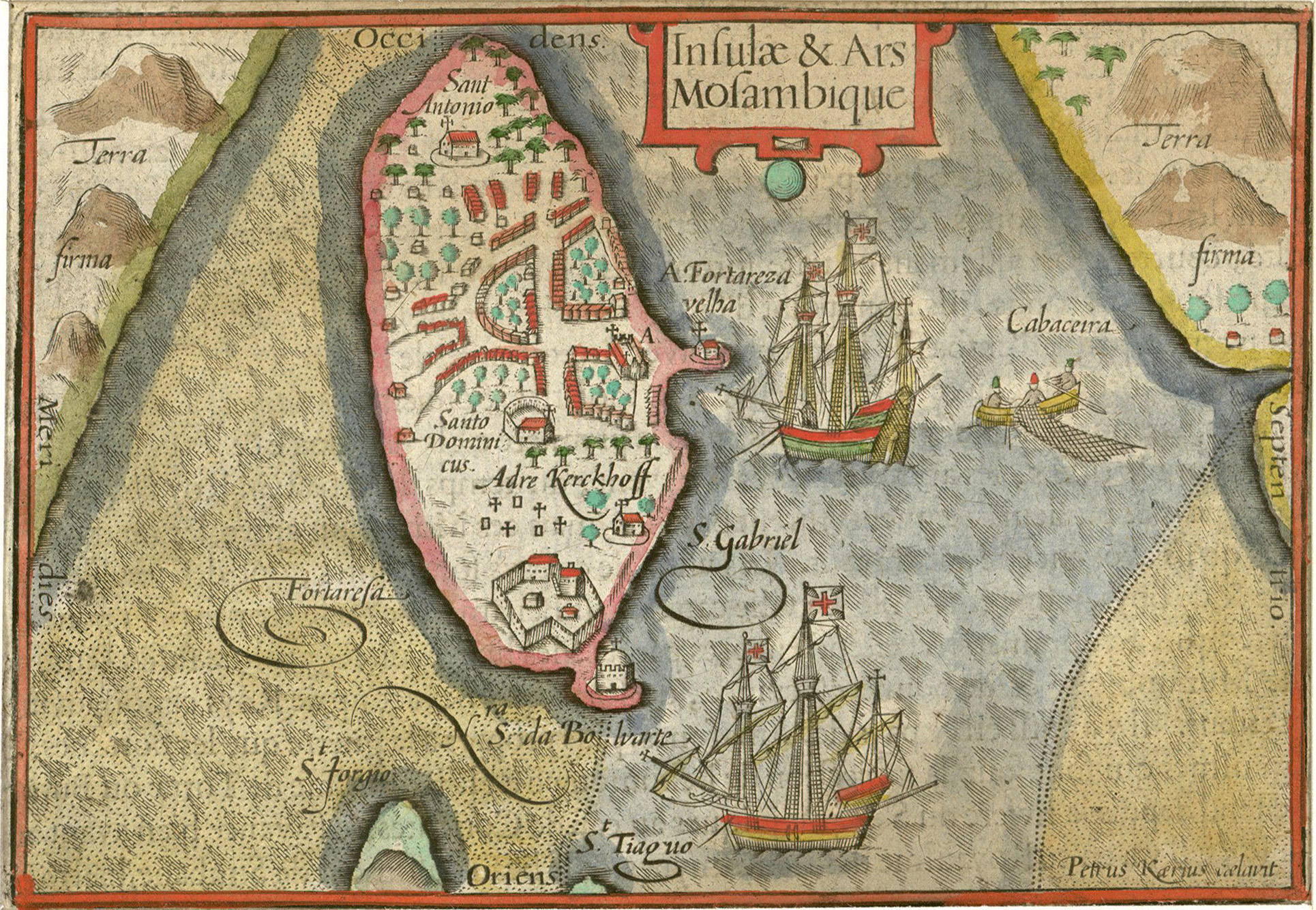
Nederlands: Kaartje van het eiland Mozambique
Português: "Insulae & Ars Mosambique" ("Ilha e fortaleza de Moçambique", Pieter van den Keere, 1598). |
|||||||||||||||||||||||||
| Rana | ||||||||||||||||||||||||||
| Masomi | Historiccities | |||||||||||||||||||||||||
| Marubucin |
|
|||||||||||||||||||||||||
| Object location | | View this and other nearby images on: OpenStreetMap |
|---|
Lasisi
|
This work is in the public domain in its country of origin and other countries and areas where the copyright term is the author's life plus 100 years or fewer. This work is in the public domain in the United States because it was published (or registered with the U.S. Copyright Office) before January 1, 1929. | |
| This file has been identified as being free of known restrictions under copyright law, including all related and neighboring rights. | |
Tarihin fayil
Ku latsa rana/lokaci ku ga fayil yadda yake a wannan lokaci
| Rana/Lokaci | Wadar sufa | Kusurwowi | Ma'aikaci | Bahasi | |
|---|---|---|---|---|---|
| na yanzu | 09:32, 16 Disamba 2010 | | 1,930 × 1,334 (1.24 MB) | Joopr | {{Information |Description={{nl|1=Kaartje van het eiland Mozambique}} |Source=[http://historic-cities.huji.ac.il/mozambique/mozambique/maps/langenes_kaerius_mozambique.html Historiccities] |Author=Pieter v d Keere |Date=1598 |Permission= |other_versions= |
Amfani da fayil
Wadannan shafi na amfani wannan fayil:
Amfanin fayil a ko'ina
Wadannan sauran wikis suna amfani da fayil din anan
- Amfani a kan af.wikipedia.org
- Amfani a kan ar.wikipedia.org
- Amfani a kan avk.wikipedia.org
- Amfani a kan az.wikipedia.org
- Amfani a kan ca.wikipedia.org
- Amfani a kan en.wikipedia.org
- Amfani a kan es.wikipedia.org
- Amfani a kan fa.wikipedia.org
- Amfani a kan fr.wikipedia.org
- Amfani a kan hr.wikipedia.org
- Amfani a kan hy.wikipedia.org
- Amfani a kan id.wikipedia.org
- Amfani a kan io.wikipedia.org
- Amfani a kan it.wikipedia.org
- Amfani a kan ja.wikipedia.org
- Amfani a kan ka.wikipedia.org
- Amfani a kan mg.wikipedia.org
- Amfani a kan mt.wikipedia.org
- Amfani a kan nl.wikipedia.org
- Amfani a kan pl.wikipedia.org
- Amfani a kan pt.wikipedia.org
- Amfani a kan pt.wikibooks.org
- Amfani a kan ru.wikipedia.org
- Amfani a kan sh.wikipedia.org
- Amfani a kan sr.wikipedia.org
- Amfani a kan vi.wikipedia.org
- Amfani a kan yo.wikipedia.org
- Amfani a kan zh.wikipedia.org