
File:American Falls Niagara Falls USA from Skylon Tower on 2002-05-28.png
Yanayin wannan rigayi gani: 800 × 450 pixels. Wasu yarjejeniyoyi: 320 × 180 pixels | 640 × 360 pixels | 1,024 × 576 pixels | 1,280 × 720 pixels | 2,560 × 1,440 pixels | 5,120 × 2,880 pixels.
Hoton asali (pikisal 5,120 × 2,880, girman fayil: 22.5 MB, irin MIME: image/png)
Taƙaici
| Bayani |
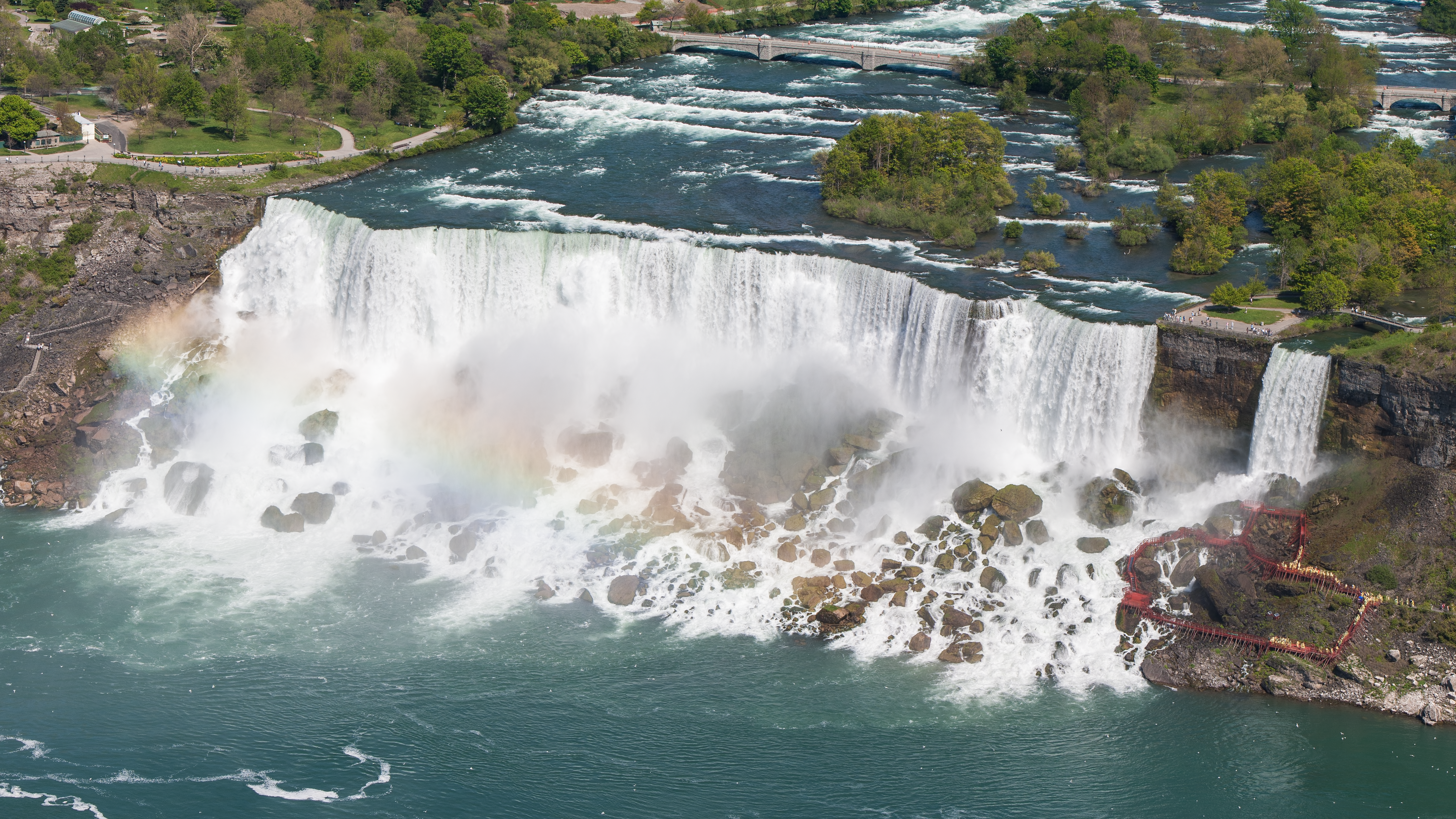
English: The American Falls and the Bridal Veil Falls of the Niagara Falls in the USA from Skylon Tower on May 28, 2002.
Deutsch: Die American Falls und die Bridal Veil Falls der Niagarafälle in den USA vom Skylon Tower aus am 28. Mai 2002.
|
||||
| Rana | |||||
| Masomi | Aikin na | ||||
| Marubucin | Robert F. Tobler | ||||
| Izini (Sake amfani da wannan fayil) |
English: This photograph was taken by Robert F. Tobler and released under the license(s) stated below. You are free to use it for any purpose as long as you credit the author, the Source (Wikimedia Commons) and the license (CC-BY-SA 4.0) in close relation to the image.
Deutsch: Dieses Foto wurde von Robert F. Tobler erstellt und unter nachfolgend aufgeführter Lizenz veröffentlicht. Das Bild kann frei verwendet werden solange der Urheber, die Quelle (Wikimedia Commons) und die Lizenz (CC-BY-SA 4.0) in erkennbarem Zusammenhang mit dem Bild genannt wird.
|
||||
| Other versions |


| Camera location | | View this and other nearby images on: OpenStreetMap |
|---|
Lasisi
I, the copyright holder of this work, hereby publish it under the following license:
This file is licensed under the Creative Commons Attribution-Share Alike 4.0 International license.
- Za ka iya:
- a raba – dan kwafa, yadawa da aika aikin
- dan maimaita – dan daukar aikin
- A karkashin wannan sharuddan
- Jinginarwa – Dole ku bada jinjina da ta dace, samar da linki zuwa lasisin, da kuma bayyana ko kunyi sauyi. Zaku iya haka ta yadda ta dace, amma ba kowace hanya ba wanda zai nuna mai-lasisin yana goyon bayan ku ba ko goyon bayan amfanin da kuke yi ba.
- Yada ahaka – Idan kuka maimaita, sabuntawa, ko kari akan wannan, dole ku bayar da gudunmuwar ku karkashin iri daya ko lasisi data dace kamar na asali.
| Annotations | This image is annotated: View the annotations at Commons |
This image has been assessed using the Quality image guidelines and is considered a Quality image.
|
Tarihin fayil
Ku latsa rana/lokaci ku ga fayil yadda yake a wannan lokaci
| Rana/Lokaci | Wadar sufa | Kusurwowi | Ma'aikaci | Bahasi | |
|---|---|---|---|---|---|
| na yanzu | 05:48, 13 ga Maris, 2016 | | 5,120 × 2,880 (22.5 MB) | Rftblr | correct 16:9 size |
| 05:41, 13 ga Maris, 2016 |  | 5,121 × 2,880 (22.51 MB) | Rftblr | slightly better color | |
| 03:18, 13 ga Maris, 2016 |  | 5,120 × 2,880 (22.46 MB) | Rftblr | tighter crop (mainly on the right) | |
| 15:54, 12 ga Maris, 2016 |  | 5,760 × 2,880 (26.02 MB) | Rftblr | slightly brighter | |
| 15:42, 12 ga Maris, 2016 |  | 5,760 × 2,880 (25.43 MB) | Rftblr | User created page with UploadWizard |
Amfani da fayil
Wadannan shafi na amfani wannan fayil:
Amfanin fayil a ko'ina
Wadannan sauran wikis suna amfani da fayil din anan
- Amfani a kan ar.wikipedia.org
- Amfani a kan bn.wikipedia.org
- Amfani a kan ca.wikipedia.org
- Amfani a kan de.wikipedia.org
- Amfani a kan de.wikivoyage.org
- Amfani a kan en.wikipedia.org
- Amfani a kan es.wikipedia.org
- Amfani a kan fa.wikipedia.org
- Amfani a kan fr.wikipedia.org
- Amfani a kan hyw.wikipedia.org
- Amfani a kan it.wikipedia.org
- Amfani a kan kw.wikipedia.org
- Amfani a kan lb.wikipedia.org
- Amfani a kan mdf.wikipedia.org
- Amfani a kan nl.wikipedia.org
- Amfani a kan si.wikipedia.org
- Amfani a kan sq.wikipedia.org
- Amfani a kan sr.wikipedia.org
- Amfani a kan vi.wikipedia.org