
File:Australia satellite plane.jpg

Yanayin wannan rigayi gani: 729 × 600 pixels. Wasu yarjejeniyoyi: 292 × 240 pixels | 583 × 480 pixels | 933 × 768 pixels | 1,245 × 1,024 pixels | 2,489 × 2,048 pixels | 5,250 × 4,320 pixels.
Hoton asali (pikisal 5,250 × 4,320, girman fayil: 1.76 MB, irin MIME: image/jpeg)
| Bayani | ||||||
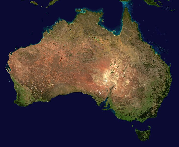
| Masomi | The image is from here, specifically http://visibleearth.nasa.gov/images/2433/land_shallow_topo_east.tif land_shallow_topo_east.tif, which was cropped at 5250x4320+13390+11880. | |||||
| Marubucin | Reto Stöckl / NASA Goddard Space Flight Center | |||||
| Izini (Sake amfani da wannan fayil) |
|
|||||
| Other versions | Derivative works of this file: Australia satellite states.jpg |

|
Tarihin fayil
Ku latsa rana/lokaci ku ga fayil yadda yake a wannan lokaci
| Rana/Lokaci | Wadar sufa | Kusurwowi | Ma'aikaci | Bahasi | |
|---|---|---|---|---|---|
| na yanzu | 16:58, 19 Mayu 2005 | | 5,250 × 4,320 (1.76 MB) | Dbenbenn | high resolution version. Cropped land_shallow_topo_east.tif at 5250x4320+13390+11880 |
| 21:10, 13 Nuwamba, 2004 |  | 800 × 672 (84 KB) | Bjarki S |
Amfani da fayil
Wadannan shafi na amfani wannan fayil:
Amfanin fayil a ko'ina
Wadannan sauran wikis suna amfani da fayil din anan
- Amfani a kan af.wikipedia.org
- Amfani a kan an.wikipedia.org
- Amfani a kan ar.wikipedia.org
- Amfani a kan ar.wiktionary.org
- Amfani a kan arz.wikipedia.org
- Amfani a kan ast.wikipedia.org
- Amfani a kan azb.wikipedia.org
- Amfani a kan ba.wikipedia.org
- Amfani a kan be-tarask.wikipedia.org
- Amfani a kan be.wikipedia.org
- Amfani a kan bh.wikipedia.org
- Amfani a kan bn.wikipedia.org
- Amfani a kan bo.wikipedia.org
- Amfani a kan br.wikipedia.org
- Amfani a kan ca.wikipedia.org
- Amfani a kan ce.wikipedia.org
- Amfani a kan ckb.wikipedia.org
- Amfani a kan cs.wikipedia.org
- Amfani a kan cy.wiktionary.org
- Amfani a kan da.wikipedia.org
- Amfani a kan de.wikipedia.org
- Amfani a kan de.wikivoyage.org
- Amfani a kan de.wiktionary.org
- Amfani a kan diq.wikipedia.org
- Amfani a kan dz.wikipedia.org
- Amfani a kan el.wikipedia.org
- Amfani a kan en.wikipedia.org
Duba ƙarin amfanin wannan fayil.