
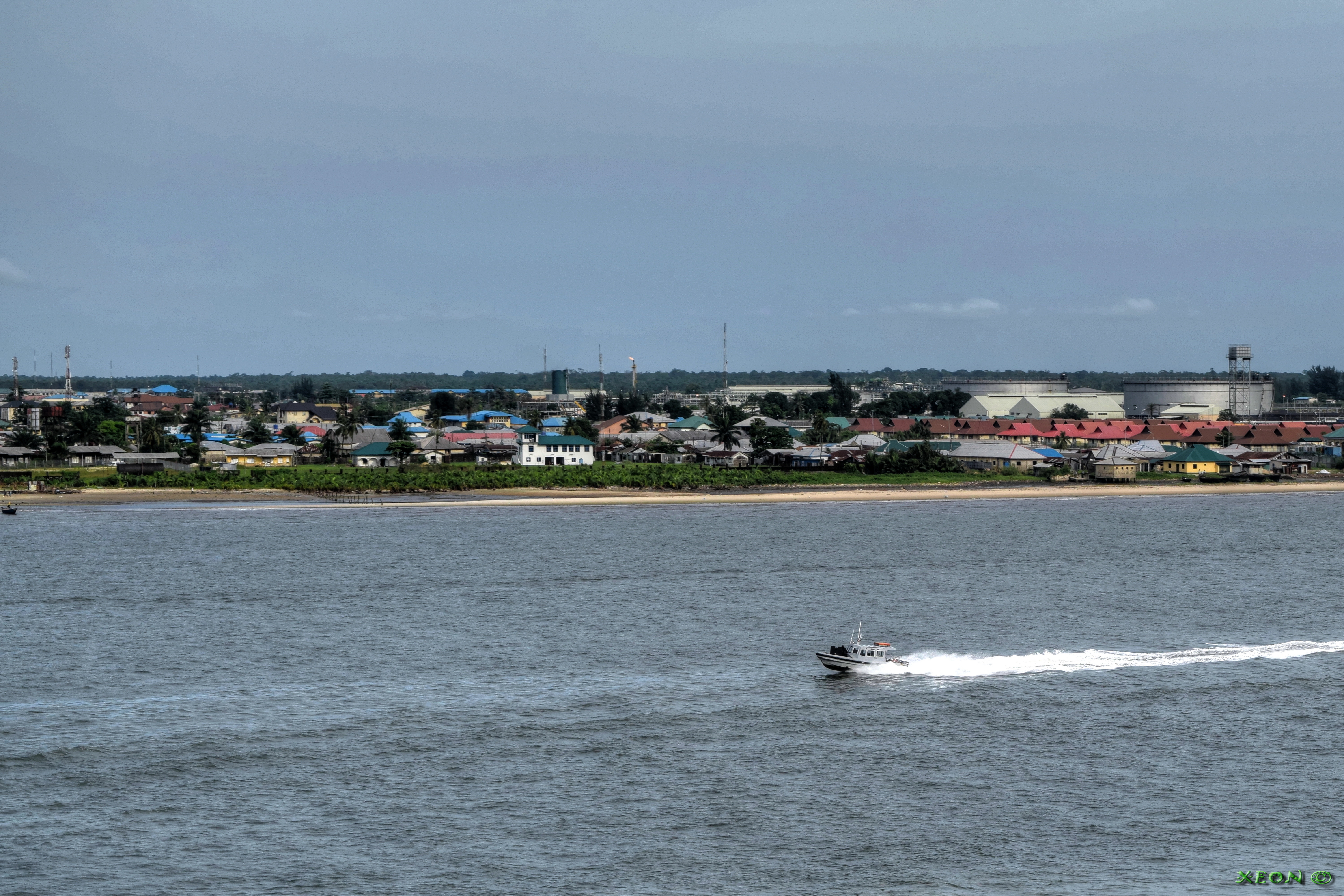
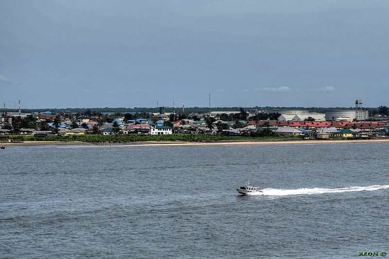
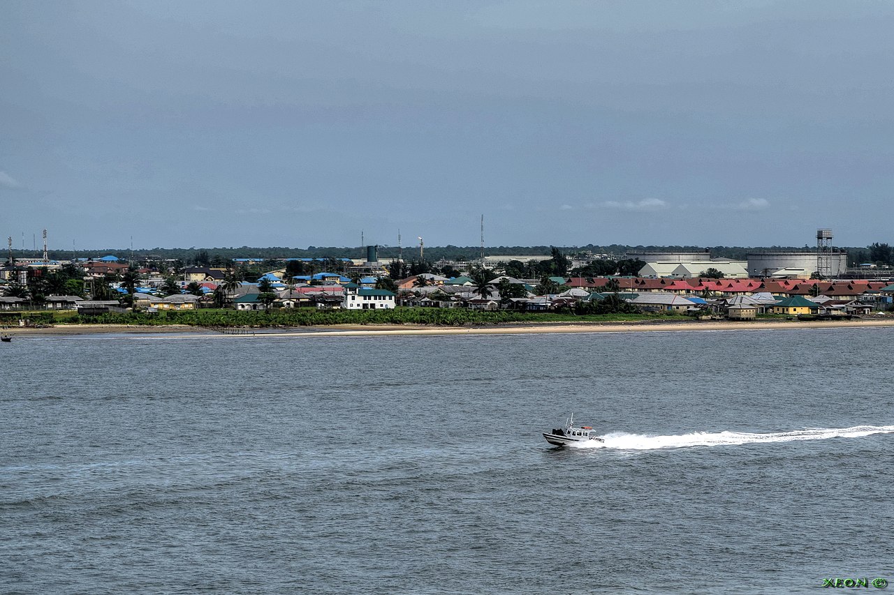
File:Bonny City - panoramio.jpg
Yanayin wannan rigayi gani: 800 × 533 pixels. Wasu yarjejeniyoyi: 320 × 213 pixels | 640 × 427 pixels | 1,024 × 683 pixels | 1,280 × 853 pixels | 2,560 × 1,707 pixels | 6,000 × 4,000 pixels.
Hoton asali (pikisal 6,000 × 4,000, girman fayil: 6.28 MB, irin MIME: image/jpeg)
Taƙaici
| Bayani | Bonny City | ||
| Rana | Taken on 23 Mayu 2015 | ||
| Masomi | https://web.archive.org/web/20161102010623/http://www.panoramio.com/photo/124810607 | ||
| Marubucin | ---=XEON=--- | ||
| Izini (Sake amfani da wannan fayil) |
This file is licensed under the Creative Commons Attribution 3.0 Unported license.
|
||
| Panoramio Tags | Bonny, 2015, Bonny River - Nigeria, Buildings - Arhitecture - Construction - Architecture, Coast - Bank - Waterfront - Waterside - River Side - Ripe - Land - Earth - Ground - Spil - Terra, Rivers - Canals - Chanals - Water - Pond - Pool - Reservuar - Fountain, Seas - Oceans - Strait - Pass - Channel - Canal - Sea Roads - Oceans Roads - Fairways - Seaway - Clearway - Harbor - Haven - Port - Seaport - Bay - Cove - Creek, Ships - Vessel - Boat - Tug - Yacht - Barge - Barche - Oil Rig - Platforms, True Position By GPS - Correct Position - WGS84 - WGS 84 - World Geodetic System 1984 |
| Camera location | | View this and other nearby images on: OpenStreetMap |
|---|
Tarihin fayil
Ku latsa rana/lokaci ku ga fayil yadda yake a wannan lokaci
| Rana/Lokaci | Wadar sufa | Kusurwowi | Ma'aikaci | Bahasi | |
|---|---|---|---|---|---|
| na yanzu | 14:19, 20 ga Yuni, 2017 | | 6,000 × 4,000 (6.28 MB) | Panoramio upload bot | == {{int:filedesc}} == {{Information |description=Bonny City |date={{Taken on|2015-05-23}} |source=http://www.panoramio.com/photo/124810607 |author=[http://www.panoramio.com/user/760796?with_photo_id=124810607 ---=XEON=---] |permission={{cc-by-3.0|---=... |
Amfani da fayil
Wadannan shafi na amfani wannan fayil:
Amfanin fayil a ko'ina
Wadannan sauran wikis suna amfani da fayil din anan
- Amfani a kan bi.wikipedia.org
- Amfani a kan ca.wikipedia.org
- Amfani a kan ceb.wikipedia.org
- Amfani a kan en.wikipedia.org
- Amfani a kan es.wikipedia.org
- Amfani a kan fr.wikipedia.org
- Amfani a kan ig.wikipedia.org
- Amfani a kan kcg.wikipedia.org
- Amfani a kan pl.wikipedia.org
- Amfani a kan pt.wikipedia.org
- Amfani a kan ru.wikipedia.org
- Amfani a kan uk.wikipedia.org
- Amfani a kan www.wikidata.org
- Amfani a kan yo.wikipedia.org
- Amfani a kan zu.wikipedia.org