
File:Ei-map.svg

Size of this PNG preview of this SVG file: 517 × 599 pixels. Wasu yarjejeniyoyi: 207 × 240 pixels | 414 × 480 pixels | 662 × 768 pixels | 883 × 1,024 pixels | 1,766 × 2,048 pixels | 652 × 756 pixels.
Hoton asali (Fayil kin SVG, saƙar fikisal 652 x 756, girman fayil: 115 KB)
Taƙaici
| Bayani |
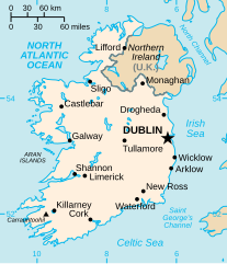
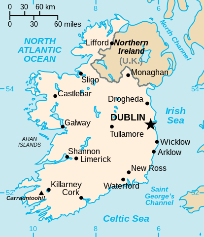
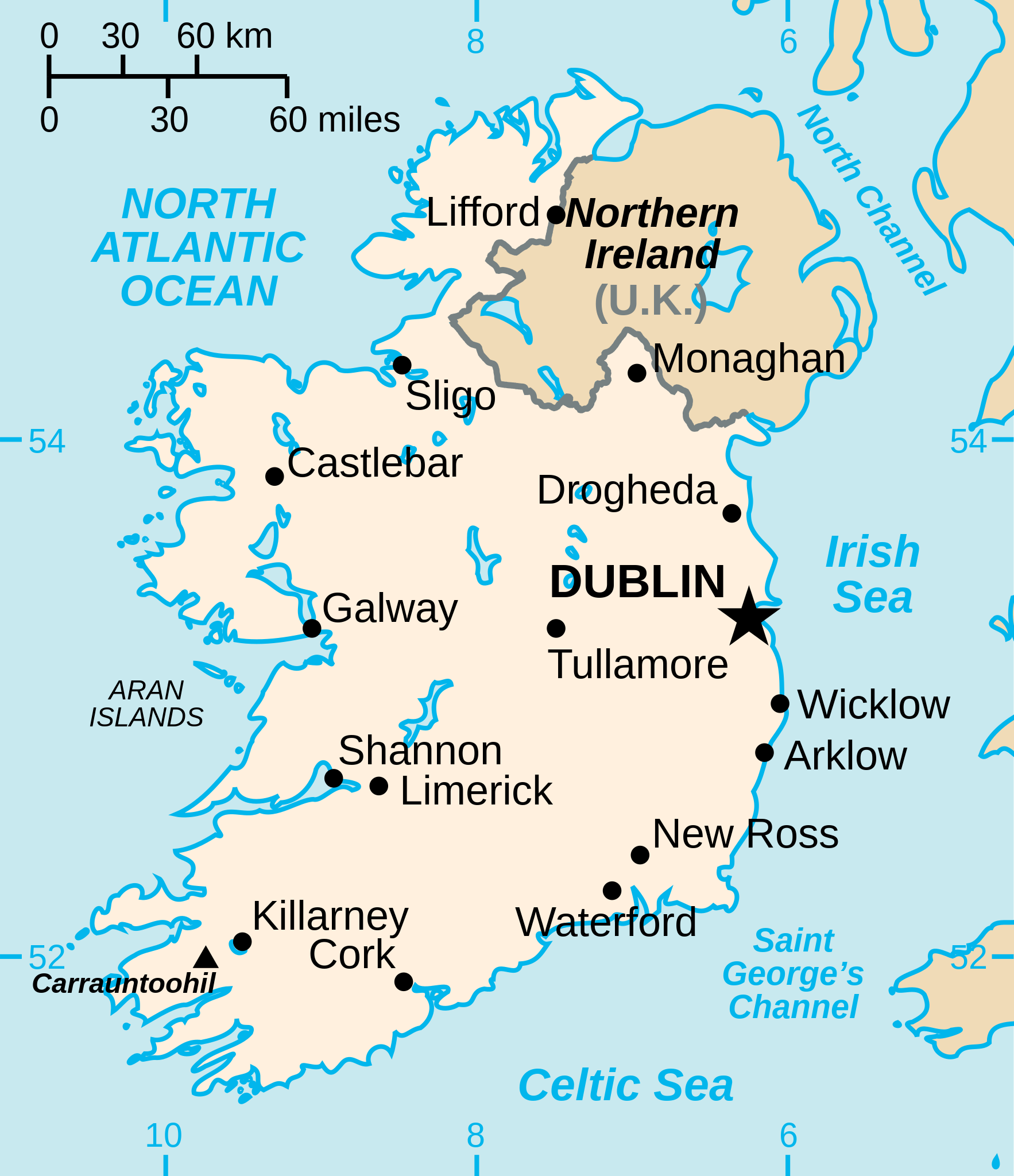
English: Vector version of CIA WorldBook map of the Republic of Ireland. Mercator projection. Vector information is from the CIA World DataBank II, and hence in the public domain. |
| Masomi |
This file was derived from: Ei-map.png |
| Marubucin | CIA World Factbook |
| Other versions |
[]
|


.svg)


Lasisi
| I, the copyright holder of this work, release this work into the public domain. This applies worldwide. In some countries this may not be legally possible; if so: I grant anyone the right to use this work for any purpose, without any conditions, unless such conditions are required by law. |
Tarihin fayil
Ku latsa rana/lokaci ku ga fayil yadda yake a wannan lokaci
| Rana/Lokaci | Wadar sufa | Kusurwowi | Ma'aikaci | Bahasi | |
|---|---|---|---|---|---|
| na yanzu | 15:16, 24 Disamba 2022 | | 652 × 756 (115 KB) | Wikijahnn | File uploaded using svgtranslate tool (https://svgtranslate.toolforge.org/). Added translation for ca. |
| 19:34, 3 Satumba 2020 |  | 652 × 756 (110 KB) | Andrei Stroe | File uploaded using svgtranslate tool (https://svgtranslate.toolforge.org/). Added translation for ro. | |
| 22:16, 24 ga Yuli, 2006 |  | 652 × 756 (99 KB) | Wereon | Vector version of CIA WorldBook map of the Republic of Ireland. Mercator projection. Vector information is from the CIA World DataBank II, and hence in the public domain. |
Amfani da fayil
Wadannan shafi na amfani wannan fayil:
Amfanin fayil a ko'ina
Wadannan sauran wikis suna amfani da fayil din anan
- Amfani a kan af.wikipedia.org
- Amfani a kan af.wiktionary.org
- Amfani a kan ang.wikipedia.org
- Amfani a kan ar.wikipedia.org
- Amfani a kan arz.wikipedia.org
- Amfani a kan ast.wikipedia.org
- Amfani a kan be-tarask.wikipedia.org
- Amfani a kan be.wikipedia.org
- Amfani a kan bg.wikipedia.org
- Amfani a kan ca.wikipedia.org
- Amfani a kan ceb.wikipedia.org
- Amfani a kan cy.wikipedia.org
- Amfani a kan da.wikipedia.org
- Amfani a kan de.wikipedia.org
- Amfani a kan de.wiktionary.org
- Amfani a kan diq.wikipedia.org
- Amfani a kan dsb.wikipedia.org
- Amfani a kan el.wikipedia.org
- Amfani a kan en.wikipedia.org
Duba ƙarin amfanin wannan fayil.