
File:Kenya sat.png

Yanayin wannan rigayi gani: 516 × 600 pixels. Wasu yarjejeniyoyi: 206 × 240 pixels | 413 × 480 pixels | 960 × 1,116 pixels.
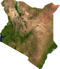
Hoton asali (pikisal 960 × 1,116, girman fayil: 1.36 MB, irin MIME: image/png)
ECW to TIFF to PNG (compression level 9).
| This file is in the public domain, because it was generated by a user, using free sources available at The Map Library.
Note that this does not include the maps in the Global Administrative Areas section of the homepage. |
Tarihin fayil
Ku latsa rana/lokaci ku ga fayil yadda yake a wannan lokaci
| Rana/Lokaci | Wadar sufa | Kusurwowi | Ma'aikaci | Bahasi | |
|---|---|---|---|---|---|
| na yanzu | 02:26, 14 ga Yuli, 2006 | | 960 × 1,116 (1.36 MB) | Unquietwiki | ECW to TIFF to PNG (compression level 9). {{PD-MapLibrary}} |
Amfani da fayil
Wadannan shafi na amfani wannan fayil:
Amfanin fayil a ko'ina
Wadannan sauran wikis suna amfani da fayil din anan
- Amfani a kan bn.wikipedia.org
- Amfani a kan de.wikipedia.org
- Amfani a kan en.wikipedia.org
- Amfani a kan fr.wikipedia.org
- Amfani a kan he.wikipedia.org
- Amfani a kan hu.wikipedia.org
- Amfani a kan ka.wikipedia.org
- Amfani a kan mdf.wikipedia.org
- Amfani a kan pt.wikipedia.org
- Amfani a kan ru.wikipedia.org
- Amfani a kan sl.wikipedia.org
- Amfani a kan tl.wikipedia.org
- Amfani a kan uk.wikipedia.org
- Amfani a kan zh.wikipedia.org