
File:Map commune FR insee code 83137.png

Hoton asali (pikisal 756 × 605, girman fayil: 85 KB, irin MIME: image/png)
Taƙaici
| Bayani |
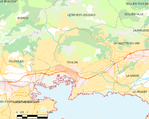
English: Map of French municipality Toulon
Français : Carte des communes françaises Toulon
Nederlands: Kaart van Franse gemeente Toulon |
|
| Rana | ||
| Masomi | derived work, see author details | |
| Marubucin |
|
_French_municipality_map.svg)
Lasisi
- Za ka iya:
- a raba – dan kwafa, yadawa da aika aikin
- dan maimaita – dan daukar aikin
- A karkashin wannan sharuddan
- Jinginarwa – Dole ku bada jinjina da ta dace, samar da linki zuwa lasisin, da kuma bayyana ko kunyi sauyi. Zaku iya haka ta yadda ta dace, amma ba kowace hanya ba wanda zai nuna mai-lasisin yana goyon bayan ku ba ko goyon bayan amfanin da kuke yi ba.
Tarihin fayil
Ku latsa rana/lokaci ku ga fayil yadda yake a wannan lokaci
| Rana/Lokaci | Wadar sufa | Kusurwowi | Ma'aikaci | Bahasi | |
|---|---|---|---|---|---|
| na yanzu | 21:13, 8 ga Yuni, 2012 | | 756 × 605 (85 KB) | RobotMichiel1972 |
Amfani da fayil
Babu shafuka da suke amfani da fayil din nan.
Amfanin fayil a ko'ina
Wadannan sauran wikis suna amfani da fayil din anan