
File:Map of OIC.png

Yanayin wannan rigayi gani: 800 × 400 pixels. Wasu yarjejeniyoyi: 320 × 160 pixels | 640 × 320 pixels | 1,250 × 625 pixels.
Hoton asali (pikisal 1,250 × 625, girman fayil: 40 KB, irin MIME: image/png)
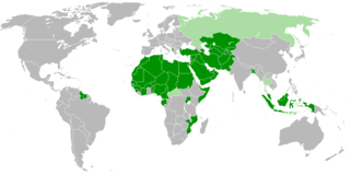
| Bayani | Members of OIC |
| Rana | |
| Masomi | Aikin na |
| Marubucin | Myrzic Cyril |
| This work is ineligible for copyright and therefore in the public domain because it consists entirely of information that is common property and contains no original authorship. |
Tarihin fayil
Ku latsa rana/lokaci ku ga fayil yadda yake a wannan lokaci
| Rana/Lokaci | Wadar sufa | Kusurwowi | Ma'aikaci | Bahasi | |
|---|---|---|---|---|---|
| na yanzu | 20:31, 2 ga Faburairu, 2018 | | 1,250 × 625 (40 KB) | Maphobbyist | Check |
| 20:26, 2 ga Faburairu, 2018 |  | 1,250 × 625 (40 KB) | Maphobbyist | Added borders of South Sudan which became idependent in 2011 and which is not a member of the OIC. | |
| 13:31, 27 ga Augusta, 2008 |  | 1,250 × 625 (55 KB) | Myrzich Cyril | {{Information |Description= |Source= |Date= |Author= |Permission= |other_versions= }} | |
| 12:53, 26 Mayu 2008 |  | 1,250 × 625 (55 KB) | Myrzich Cyril | {{Information |Description= Members of OIC |Source= Собственная работа |Date= may 26, 2008 |Author= Myrzich Cyril |Permission= |other_versions= }} {{PD-ineligible}} Category:Subcontinental maps | |
| 12:31, 26 Mayu 2008 |  | 1,250 × 625 (55 KB) | Myrzich Cyril | {{Information |Description= Members of OIC |Source= Собственная работа |Date= may 26, 2008 |Author= Myrzic Cyril |Permission= |other_versions= }} {{PD-ineligible}} Category:Subcontinental maps |
Amfani da fayil
Babu shafuka da suke amfani da fayil din nan.
Amfanin fayil a ko'ina
Wadannan sauran wikis suna amfani da fayil din anan
- Amfani a kan be.wikipedia.org
- Amfani a kan en.wikipedia.org
- Amfani a kan es.wikipedia.org
- Amfani a kan fa.wikipedia.org
- Amfani a kan fr.wikipedia.org
- Amfani a kan he.wikipedia.org
- Amfani a kan it.wikipedia.org
- Amfani a kan uk.wikipedia.org