
File:MinasGerais Municip CoronelFabriciano.svg

Hoton asali (Fayil kin SVG, saƙar fikisal 2,147 x 1,723, girman fayil: 2.9 MB)

|
Standardization of derivative maps
Feel free to create derivations of this work, but if you want to illustrate a Wikipedia article with derivative works of this or similar maps of Brazil, please strictly follow the visual standard, nomenclature and classification already in use. All maps of Brazilian subdivisions are being adaptated or created in this way. We do not want to inhibit creativity but the pattern adopted here was presented and accepted by the Lusophone community and should be followed whenever possible. |
Taƙaici
| Bayani |
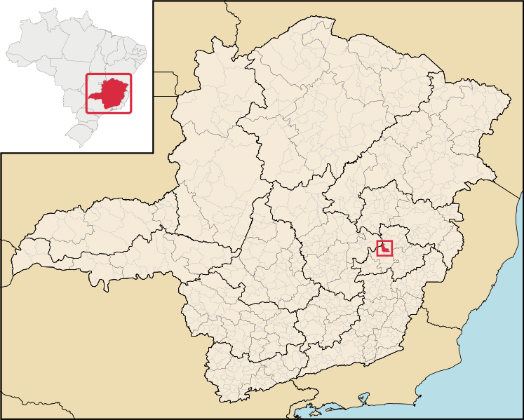
English: Location map of the municipality of Coronel Fabriciano in Minas Gerais state, Brazil.
Português: Localização do município de Coronel Fabriciano no estado de Minas Gerais, Brasil. |
| Rana | |
| Masomi | File:Brazil Minas Gerais location map.svg (derivate for File:MinasGerais MesoMicroMunicip.svg) |
| Marubucin |
Lasisi
- Za ka iya:
- a raba – dan kwafa, yadawa da aika aikin
- dan maimaita – dan daukar aikin
- A karkashin wannan sharuddan
- Jinginarwa – Dole ku bada jinjina da ta dace, samar da linki zuwa lasisin, da kuma bayyana ko kunyi sauyi. Zaku iya haka ta yadda ta dace, amma ba kowace hanya ba wanda zai nuna mai-lasisin yana goyon bayan ku ba ko goyon bayan amfanin da kuke yi ba.
Tarihin fayil
Ku latsa rana/lokaci ku ga fayil yadda yake a wannan lokaci
| Rana/Lokaci | Wadar sufa | Kusurwowi | Ma'aikaci | Bahasi | |
|---|---|---|---|---|---|
| na yanzu | 18:13, 29 ga Yuni, 2020 | | 2,147 × 1,723 (2.9 MB) | Apollo BR | Atualização das mesorregiões e microrregiões de Minas Gerais para regiões geográficas intermediárias e regiões geográficas imediatas, respectivamente, segundo nova classificação do IBGE de 2017. Fonte: IBGE 2017 <https://www.ibge.gov.br/apps/regioes_geograficas/> Base Cartográfica: IBGE 2019 <https://www.ibge.gov.br/geociencias/organizacao-do-territorio/15774-malhas.html?=&t=downloads> Elaboração: Trabalho próprio, com o software QGIS. Formatação das camadas: MINAS GERAIS: borda= 0,66 mm... |
| 22:59, 29 Disamba 2018 |  | 914 × 709 (2.43 MB) | HVL | Removing regional division extinguished | |
| 04:45, 28 ga Augusta, 2006 |  | 914 × 709 (1.91 MB) | Raphael.lorenzeto | {{Information| |Description=Map locator of a city in Minas Gerais (this description will be changed) |Source=Image:MinasGerais MesoMicroMunicip.svg, own work |Date=August 28, 2006 |Author=Raphael Lorenzeto de Abreu |Permission={{self2|GFDL|cc-by-2.5} |
Amfani da fayil
Wadannan shafi na amfani wannan fayil:
Amfanin fayil a ko'ina
Wadannan sauran wikis suna amfani da fayil din anan
- Amfani a kan ar.wikipedia.org
- Amfani a kan bcl.wikipedia.org
- Amfani a kan bpy.wikipedia.org
- Amfani a kan ca.wikipedia.org
- Amfani a kan ch.wikipedia.org
- Amfani a kan de.wikipedia.org
- Amfani a kan en.wikipedia.org
- Amfani a kan eo.wikipedia.org
- Amfani a kan es.wikipedia.org
- Amfani a kan eu.wikipedia.org
- Amfani a kan fa.wikipedia.org
- Amfani a kan ff.wikipedia.org
- Amfani a kan fj.wikipedia.org
- Amfani a kan gl.wikipedia.org
- Amfani a kan hr.wikipedia.org
- Amfani a kan ia.wikipedia.org
- Amfani a kan id.wikipedia.org
- Amfani a kan incubator.wikimedia.org
- Amfani a kan io.wikipedia.org
- Amfani a kan it.wikipedia.org
- Amfani a kan kaa.wikipedia.org
- Amfani a kan ko.wikipedia.org
- Amfani a kan la.wikipedia.org
- Amfani a kan lg.wikipedia.org
- Amfani a kan ms.wikipedia.org
- Amfani a kan mt.wikipedia.org
- Amfani a kan mwl.wikipedia.org
- Amfani a kan nl.wikipedia.org
- Amfani a kan nn.wikipedia.org
- Amfani a kan nov.wikipedia.org
- Amfani a kan no.wikipedia.org
- Amfani a kan oc.wikipedia.org
- Amfani a kan pt.wikipedia.org
- Amfani a kan pt.wikibooks.org
- Amfani a kan ro.wikipedia.org
- Amfani a kan sh.wikipedia.org
- Amfani a kan simple.wikipedia.org
- Amfani a kan sm.wikipedia.org
- Amfani a kan ss.wikipedia.org
- Amfani a kan sv.wikipedia.org
- Amfani a kan tt.wikipedia.org
- Amfani a kan uk.wikipedia.org
- Amfani a kan vi.wikipedia.org
- Amfani a kan vo.wikipedia.org
Duba ƙarin amfanin wannan fayil.