
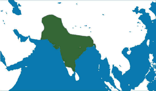
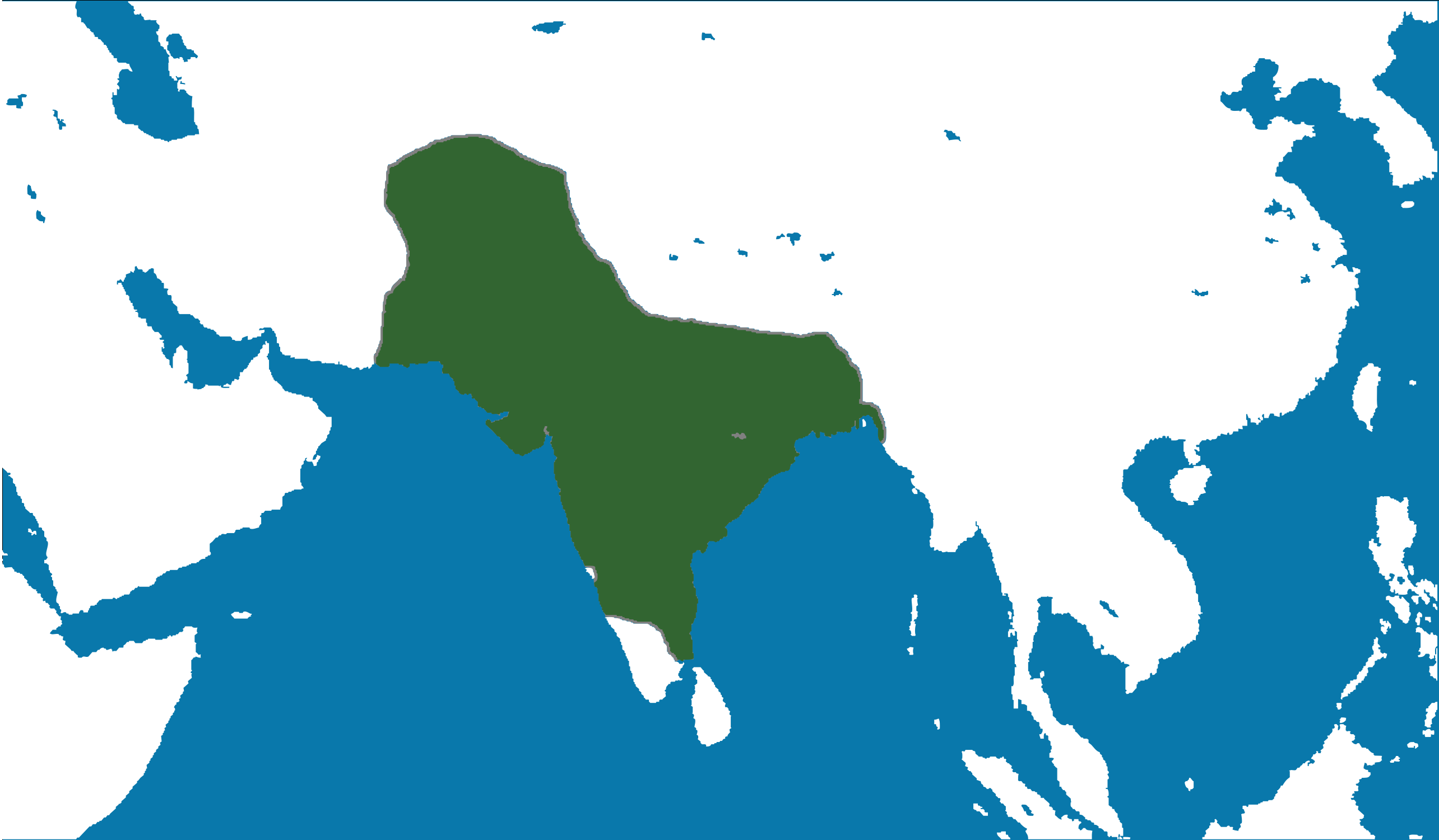
File:MughalEmpire1700.svg

Size of this PNG preview of this SVG file: 800 × 467 pixels. Wasu yarjejeniyoyi: 320 × 187 pixels | 640 × 374 pixels | 1,024 × 598 pixels | 1,280 × 748 pixels | 2,560 × 1,495 pixels | 2,568 × 1,500 pixels.
Hoton asali (Fayil kin SVG, saƙar fikisal 2,568 x 1,500, girman fayil: 147 KB)
| Bayani |
English: Locator map of the Mughal Empire, c. 1700.
(Partially based on Atlas of World History (2007) - The World 1600-1700, map) |
|||
| Rana | ||||
| Masomi | Aikin na | |||
| Marubucin | nafSadh | |||
| Izini (Sake amfani da wannan fayil) |
I, the copyright holder of this work, hereby publish it under the following license:
|
Tarihin fayil
Ku latsa rana/lokaci ku ga fayil yadda yake a wannan lokaci
| Rana/Lokaci | Wadar sufa | Kusurwowi | Ma'aikaci | Bahasi | |
|---|---|---|---|---|---|
| na yanzu | 15:27, 8 ga Yuni, 2011 | | 2,568 × 1,500 (147 KB) | Nafsadh | Mughal Empire in 1700 CE. |
Amfani da fayil
Wadannan shafi na amfani wannan fayil:
Amfanin fayil a ko'ina
Wadannan sauran wikis suna amfani da fayil din anan
- Amfani a kan ast.wikipedia.org
- Amfani a kan bg.wikipedia.org
- Amfani a kan bn.wikipedia.org
- Amfani a kan ca.wikipedia.org
- Amfani a kan cs.wikipedia.org
- Amfani a kan cy.wikipedia.org
- Amfani a kan en.wikipedia.org
- Amfani a kan es.wikipedia.org
- Amfani a kan eu.wikipedia.org
- Amfani a kan ga.wikipedia.org
- Amfani a kan gl.wikipedia.org
- Amfani a kan hi.wikipedia.org
- Amfani a kan hr.wikipedia.org
- Amfani a kan io.wikipedia.org
- Amfani a kan ja.wikipedia.org
- Amfani a kan kab.wikipedia.org
- Amfani a kan lv.wikipedia.org
- Amfani a kan ms.wikipedia.org
- Amfani a kan pnb.wikipedia.org
- Amfani a kan sh.wikipedia.org
- Amfani a kan ta.wikipedia.org
- Amfani a kan tk.wikipedia.org
- Amfani a kan uk.wikipedia.org
- Amfani a kan vi.wikipedia.org
- Amfani a kan www.wikidata.org