
File:NO 1103 Stavanger.svg

Size of this PNG preview of this SVG file: 465 × 600 pixels. Wasu yarjejeniyoyi: 186 × 240 pixels | 372 × 480 pixels | 595 × 768 pixels | 794 × 1,024 pixels | 1,588 × 2,048 pixels | 635 × 819 pixels.
Hoton asali (Fayil kin SVG, saƙar fikisal 635 x 819, girman fayil: 178 KB)
| Bayani |
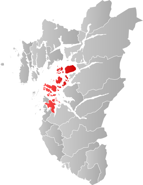
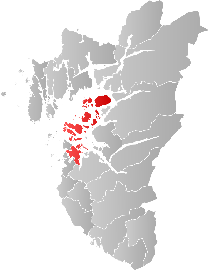
Norsk bokmål: Kart som viser [[:no: {{{1}}}| {{{1}}}]]s plassering innen [[:no: {{{2}}}| {{{2}}}]], laga av Jon Harald Søby.
English: Map showing the position of [[:w: {{{1}}}| {{{1}}}]] within [[:w: {{{2}}}| {{{2}}}]], made by Jon Harald Søby.
Svenska: Karta som visar [[:sv: {{{1}}}| {{{1}}}]] kommuns läge i [[:Category:{{{2}}}|{{{2}}}]] fylke, skapad av Jon Harald Søby. |
||
| Rana | |||
| Masomi | Aikin na | ||
| Marubucin | Jon Harald Søby | ||
| Izini (Sake amfani da wannan fayil) |
|
||
| SVG genesis |
[[Category:Locator maps of {{{2}}}]] [[Category:{{{1}}}]]
Tarihin fayil
Ku latsa rana/lokaci ku ga fayil yadda yake a wannan lokaci
| Rana/Lokaci | Wadar sufa | Kusurwowi | Ma'aikaci | Bahasi | |
|---|---|---|---|---|---|
| na yanzu | 02:42, 23 Disamba 2019 | | 635 × 819 (178 KB) | Jay1279 | update with 2020 municipal border changes |
| 18:07, 22 ga Janairu, 2007 |  | 544 × 712 (105 KB) | Jon Harald Søby | {{User:Jon Harald Søby/Kartlisens|Stavanger|Rogaland}} |
Amfani da fayil
Wadannan shafi na amfani wannan fayil:
Amfanin fayil a ko'ina
Wadannan sauran wikis suna amfani da fayil din anan
- Amfani a kan af.wikipedia.org
- Amfani a kan ar.wikipedia.org
- Amfani a kan arz.wikipedia.org
- Amfani a kan bpy.wikipedia.org
- Amfani a kan bs.wikipedia.org
- Amfani a kan ca.wikipedia.org
- Amfani a kan ce.wikipedia.org
- Amfani a kan da.wikipedia.org
- Amfani a kan de.wikipedia.org
- Amfani a kan el.wikipedia.org
- Amfani a kan en.wikipedia.org
- Amfani a kan eo.wikipedia.org
- Amfani a kan es.wikipedia.org
- Amfani a kan eu.wikipedia.org
- Amfani a kan fa.wikipedia.org
- Amfani a kan fo.wikipedia.org
- Amfani a kan fr.wikipedia.org
- Amfani a kan gl.wikipedia.org
- Amfani a kan hu.wikipedia.org
- Amfani a kan hy.wikipedia.org
- Amfani a kan ia.wikipedia.org
- Amfani a kan ie.wikipedia.org
- Amfani a kan it.wikipedia.org
- Amfani a kan ja.wikipedia.org
- Amfani a kan ka.wikipedia.org
- Amfani a kan ko.wikipedia.org
- Amfani a kan la.wikipedia.org
- Amfani a kan li.wikipedia.org
- Amfani a kan nds.wikipedia.org
- Amfani a kan nl.wikipedia.org
- Amfani a kan nn.wikipedia.org
- Amfani a kan no.wikipedia.org
Duba ƙarin amfanin wannan fayil.