
File:USA territorial growth.gif

Yanayin wannan rigayi gani: 800 × 498 pixels. Wasu yarjejeniyoyi: 320 × 199 pixels | 640 × 398 pixels | 921 × 573 pixels.
Hoton asali (pikisal 921 × 573, girman fayil: 2.01 MB, irin MIME: image/gif, looped, 10 frames, Daƙiƙa 50)
Taƙaici
| Bayani |
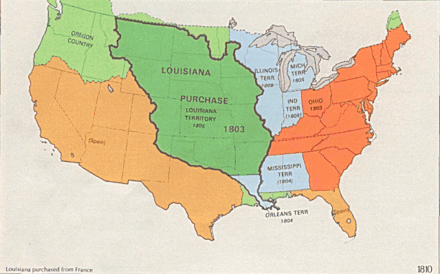
English: US territorial growth 1810–1920, based on the PD USGS maps in Category:Territorial growth maps of the United States.
See key below for explanation of colors.  |
||||||
| Masomi |
|
||||||
| Marubucin |
|
||||||
| Other versions |
|

Lasisi
This image is in the public domain in the United States because it only contains materials that originally came from the United States Geological Survey, an agency of the United States Department of the Interior. For more information, see the official USGS copyright policy.
|
Tarihin fayil
Ku latsa rana/lokaci ku ga fayil yadda yake a wannan lokaci
| Rana/Lokaci | Wadar sufa | Kusurwowi | Ma'aikaci | Bahasi | |
|---|---|---|---|---|---|
| na yanzu | 01:39, 31 Mayu 2006 | | 921 × 573 (2.01 MB) | Roke~commonswiki | longer interval, 3 seconds --> 5 seconds |
| 12:21, 30 Mayu 2006 |  | 921 × 573 (2.67 MB) | Roke~commonswiki | US territorial growth 1810-1920, based on the USGS maps in commons:Category:USA Territorial Growth Maps, put together in Corel Painter IX. The individual maps have this licence: {{PD-USGov-USGS}} If it is necessary for me to licence my contributio |
Amfani da fayil
Wadannan shafi na amfani wannan fayil:
Amfanin fayil a ko'ina
Wadannan sauran wikis suna amfani da fayil din anan
- Amfani a kan bn.wikipedia.org
- Amfani a kan en.wikipedia.org
- Amfani a kan es.wikipedia.org
- Amfani a kan fa.wikipedia.org
- Amfani a kan fy.wikipedia.org
- Amfani a kan he.wikipedia.org
- Amfani a kan nl.wikipedia.org
- Amfani a kan pnb.wikipedia.org
- Amfani a kan ru.wikipedia.org
- Amfani a kan ru.wikinews.org
- Amfani a kan sr.wikipedia.org
- Amfani a kan tr.wikipedia.org
- Amfani a kan ur.wikipedia.org
- Amfani a kan uz.wikipedia.org
- Amfani a kan www.wikidata.org