
File:Boerenkrokus (Crocus tommasinianus) 28-02-2023 (d.j.b.).jpg

Hoton asali (pikisal 2,717 × 2,717, girman fayil: 5.18 MB, irin MIME: image/jpeg)
_28-02-2023_(d.j.b.).jpg)
Taƙaici
| Bayani |
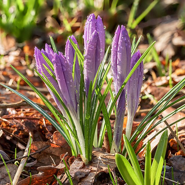
Nederlands: Met regendruppels bedekte Crocus tommasinianus Focus stapel van 15 foto’s.
English: Covered with raindrops Crocus tommasinianus Focus stack of 15 photos. |
| Rana | |
| Masomi | Aikin na |
| Marubucin | Dominicus Johannes Bergsma |
| Camera location | | View this and other nearby images on: OpenStreetMap |
|---|
_28-02-2023_(d.j.b.).jpg¶ms=052.969900_N_0005.785300_E_globe:Earth_type:camera__&language=ha)
|
_28-02-2023_(d.j.b.).jpg)

|
NOTE: This image is a focus stacked image consisting of multiple images that were merged using software. As a result, this image underwent digital manipulation which may have included blending, blurring, cloning, and colour and perspective adjustments. As a result of these adjustments, the image content may be slightly different than reality at the points where the images were combined. This manipulation is often required due to lens, perspective, and parallax distortions.
|
Locatie: Natuurterrein De Famberhorst is een belangrijke schakel in de ecologische verbinding (groene as) tussen het Friese merengebied, natuurgebied De Twigen, historische windsingel Omkromte, het natuurterrein De Famberhorst en park Heremastate in Joure.
English: Location: The Famberhorst nature reserve is an important link in the ecological connection (green axis) between the Frisian lakes, the historic windbreak Omkromte, the nature reserve and park The Famberhorst Heremastate in Joure.
Lasisi
- Za ka iya:
- a raba – dan kwafa, yadawa da aika aikin
- dan maimaita – dan daukar aikin
- A karkashin wannan sharuddan
- Jinginarwa – Dole ku bada jinjina da ta dace, samar da linki zuwa lasisin, da kuma bayyana ko kunyi sauyi. Zaku iya haka ta yadda ta dace, amma ba kowace hanya ba wanda zai nuna mai-lasisin yana goyon bayan ku ba ko goyon bayan amfanin da kuke yi ba.
- Yada ahaka – Idan kuka maimaita, sabuntawa, ko kari akan wannan, dole ku bayar da gudunmuwar ku karkashin iri daya ko lasisi data dace kamar na asali.
This image has been assessed using the Quality image guidelines and is considered a Quality image.
|
Tarihin fayil
Ku latsa rana/lokaci ku ga fayil yadda yake a wannan lokaci
| Rana/Lokaci | Wadar sufa | Kusurwowi | Ma'aikaci | Bahasi | |
|---|---|---|---|---|---|
| na yanzu | 05:44, 2 ga Maris, 2023 | | 2,717 × 2,717 (5.18 MB) | Famberhorst | Uploaded own work with UploadWizard |
Amfani da fayil
Wadannan shafi na amfani wannan fayil:
Amfanin fayil a ko'ina
Wadannan sauran wikis suna amfani da fayil din anan
- Amfani a kan bn.wikipedia.org
- Amfani a kan ca.wikipedia.org
- Amfani a kan cs.wikipedia.org
- Amfani a kan de.wikipedia.org
- Amfani a kan en.wikipedia.org
- User talk:Guettarda
- User talk:Anon423
- User talk:MassiveEartha
- User talk:Hadi
- User talk:Harvinder Chandigarh
- User talk:Anass Sedrati
- User talk:SIVAHAKASH
- User talk:Timmylegend
- User talk:Godstime Elijah
- User talk:James Moore200
- User talk:Ptinphusmia
- User talk:Cnyirahabihirwe123
- User talk:Zend2020
- User talk:RukayatAjeigbe
- User talk:Omorodion1/Archive 4
- User talk:Yohannvt/Archive 9
- User talk:Gobonobo/Archive 60
- User talk:Em-mustapha/Archive 12
- User talk:OhKayeSierra/Archive 18
- User talk:Peaceray/archive/2023
- User talk:Daylen/Archive 2023
- User talk:Wil540 art/Archive 6
- User talk:Ambrosia10/Archive 6
- Amfani a kan es.wikipedia.org
- Amfani a kan fr.wikipedia.org
- Amfani a kan hi.wikipedia.org
- Amfani a kan ig.wikipedia.org
- Amfani a kan it.wikipedia.org
Duba ƙarin amfanin wannan fayil.
_28-02-2023_(d.j.b.).jpg)
_28-02-2023_(d.j.b.).jpg)