
File:Daniel Utah welcome sign.jpeg

Yanayin wannan rigayi gani: 800 × 600 pixels. Wasu yarjejeniyoyi: 320 × 240 pixels | 640 × 480 pixels | 1,024 × 768 pixels | 1,280 × 960 pixels | 2,560 × 1,920 pixels.
Hoton asali (pikisal 2,560 × 1,920, girman fayil: 1 MB, irin MIME: image/jpeg)
Taƙaici
| Bayani | |
| Rana | Taken on 21 Mayu 2010 |
| Masomi | Aikin na |
| Marubucin | Ntsimp |
| Camera location | | View this and other nearby images on: OpenStreetMap |
|---|
Lasisi
| I, the copyright holder of this work, release this work into the public domain. This applies worldwide. In some countries this may not be legally possible; if so: I grant anyone the right to use this work for any purpose, without any conditions, unless such conditions are required by law. |
Tarihin fayil
Ku latsa rana/lokaci ku ga fayil yadda yake a wannan lokaci
| Rana/Lokaci | Wadar sufa | Kusurwowi | Ma'aikaci | Bahasi | |
|---|---|---|---|---|---|
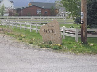
| na yanzu | 04:16, 23 Mayu 2010 | | 2,560 × 1,920 (1 MB) | Ntsimp | {{Information |Description={{en|1=Welcome sign in the town of en:Daniel, Utah, en:Utah, en:United States.}} |Source={{own}} |Author=Ntsimp |Date=2010-05-21 |Permission= |other_versions= }} {{Location|40|28|14.75|N|111|24| |
Amfani da fayil
Wadannan shafi na amfani wannan fayil:
Amfanin fayil a ko'ina
Wadannan sauran wikis suna amfani da fayil din anan
- Amfani a kan ar.wikipedia.org
- Amfani a kan azb.wikipedia.org
- Amfani a kan ca.wikipedia.org
- Amfani a kan ceb.wikipedia.org
- Amfani a kan ce.wikipedia.org
- Amfani a kan cy.wikipedia.org
- Amfani a kan en.wikipedia.org
- Amfani a kan es.wikipedia.org
- Amfani a kan eu.wikipedia.org
- Amfani a kan fa.wikipedia.org
- Amfani a kan fr.wikipedia.org
- Amfani a kan it.wikipedia.org
- Amfani a kan lld.wikipedia.org
- Amfani a kan pl.wikipedia.org
- Amfani a kan pt.wikipedia.org
- Amfani a kan sh.wikipedia.org
- Amfani a kan sr.wikipedia.org
- Amfani a kan tt.wikipedia.org
- Amfani a kan uk.wikipedia.org
- Amfani a kan uz.wikipedia.org
- Amfani a kan www.wikidata.org
- Amfani a kan zh-min-nan.wikipedia.org