
File:Diehls Covered Bridge.jpg
Yanayin wannan rigayi gani: 800 × 549 pixels. Wasu yarjejeniyoyi: 320 × 220 pixels | 640 × 439 pixels | 1,024 × 703 pixels | 1,280 × 879 pixels | 2,560 × 1,758 pixels | 4,772 × 3,277 pixels.
Hoton asali (pikisal 4,772 × 3,277, girman fayil: 1.67 MB, irin MIME: image/jpeg)
|
This is an image of a place or building that is listed on the National Register of Historic Places in the United States of America. Its reference number is 80003420. |
| Camera location | | View this and other nearby images on: OpenStreetMap |
|---|
| Bayani |
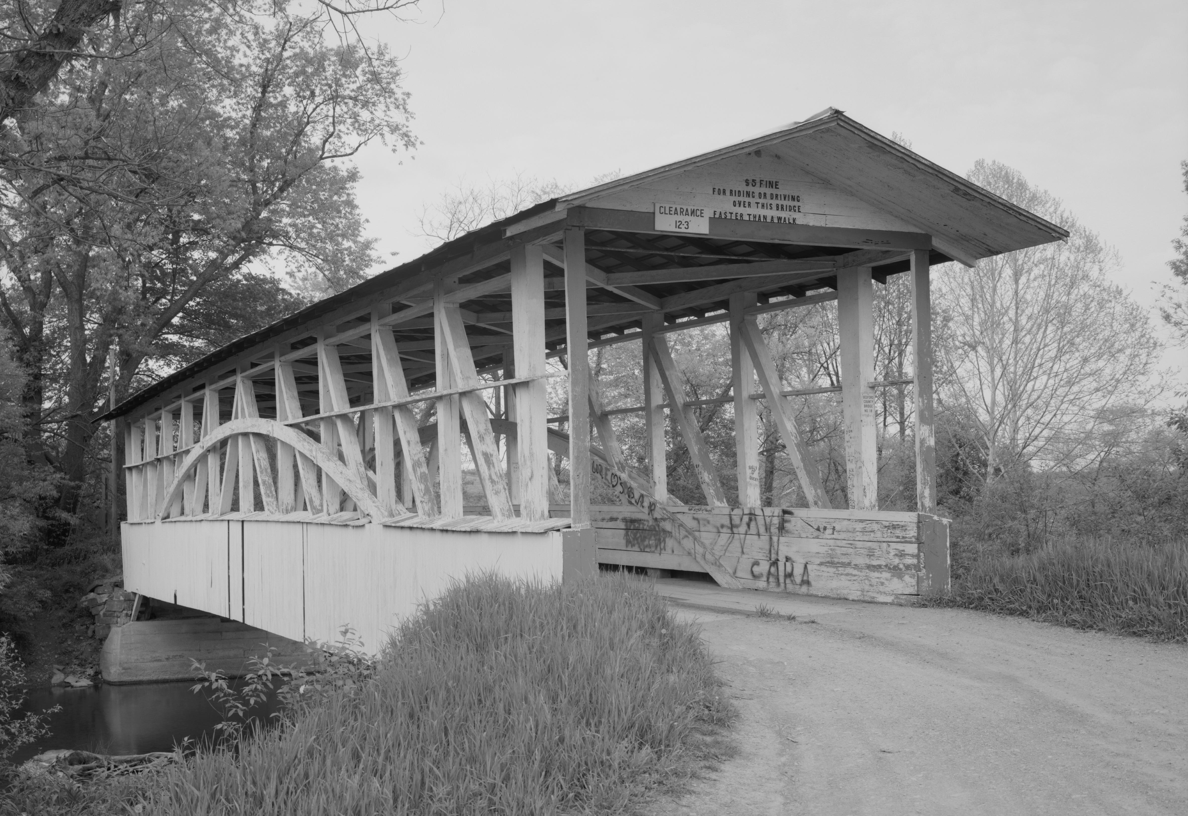
English: Southern end of the Diehls Covered Bridge, which carries Township Route 418 over the Raystown Branch of the Juniata River south of Schellsburg in Harrison and Napier Townships of Bedford County, Pennsylvania, United States. Built in 1892, this Burr arch truss bridge is listed on the National Register of Historic Places. |
|||||||||||||||||||||||
| Rana | ||||||||||||||||||||||||
| Masomi | Library of Congress, Prints and Photograph Division HAER: PA,5-MANCH.V,1-1 | |||||||||||||||||||||||
| Marubucin |
|
|||||||||||||||||||||||
| Izini (Sake amfani da wannan fayil) |
|
|||||||||||||||||||||||
.jpg)

|
This image is available from the United States Library of Congress's Prints and Photographs division
under the digital ID hhh.pa3207. This tag does not indicate the copyright status of the attached work. A normal copyright tag is still required. See Commons:Licensing.
|
Tarihin fayil
Ku latsa rana/lokaci ku ga fayil yadda yake a wannan lokaci
| Rana/Lokaci | Wadar sufa | Kusurwowi | Ma'aikaci | Bahasi | |
|---|---|---|---|---|---|
| na yanzu | 13:51, 21 Disamba 2009 | | 4,772 × 3,277 (1.67 MB) | Nyttend | {{Location|40|0|34|N|78|38|55|W}} {{Information |Description={{en|Southern end of the {{w|Diehls Covered Bridge}}, which carries Township Route 418 over the {{w|Raystown Branch Juniata River|Raystown Branch}} of the {{w|Juniata River}} south of {{w|Schell |
Amfani da fayil
Wadannan shafi na amfani wannan fayil:
Amfanin fayil a ko'ina
Wadannan sauran wikis suna amfani da fayil din anan
- Amfani a kan ca.wikipedia.org
- Amfani a kan en.wikipedia.org
- Amfani a kan es.wikipedia.org
- Amfani a kan fr.wikipedia.org
- Amfani a kan it.wikipedia.org
- Amfani a kan tl.wikipedia.org
- Amfani a kan uk.wikipedia.org
- Amfani a kan ur.wikipedia.org
- Amfani a kan vi.wikipedia.org
- Amfani a kan www.wikidata.org