
File:Dollysbrae Road - geograph.org.uk - 100732.jpg
Babu wata babbar saƙa.
Dollysbrae_Road_-_geograph.org.uk_-_100732.jpg (pikisal 640 × 480, girman fayil: 101 KB, irin MIME: image/jpeg)
Taƙaici
| Bayani |
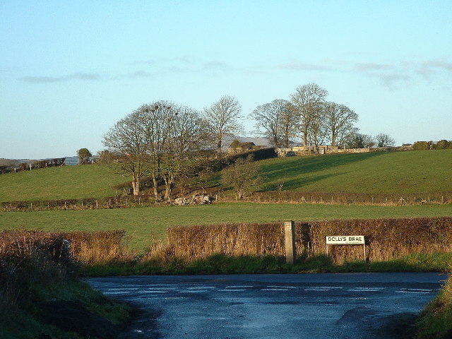
English: Dollysbrae Road. On July 12, 1849, Orangemen march from Rathfriland to Tollymore Park in County Down, Ireland to celebrate the anniversary of the Battle of Boyne, where William of Orange defeated the Catholic King James II of England. While passing through Magheramayo, which was predominantly Catholic, the group exchanged shots with a number of Ribbonmen. Ribbonism was a strongly Catholic Irish independence movement loosely associated with areas of Ulster and northern Connacht. The Orangemen proceeded to attack Catholic houses within the town, and roughly 30 Catholic people were killed. The event was subsequently known as Dolly's Brae. This incident led to the Party Processions Act.
On the 12th July 1849 the Orange Lodges of Ballyward District had visited Tollymore Park to honour the 4th Earl of Roden who was the Grand Master of Ireland. The Lodges turned homewards in procession through Bryansford, leaving Castlewellan by the old county road which now forms the southern boundary of Castlewellan Forest Park. |
| Rana | |
| Masomi | From geograph.org.uk |
| Marubucin | Kevin O'Kane |
| Jinginarwa (required by the license) | Kevin O'Kane / Dollysbrae Road / |
| Object location | | View this and other nearby images on: OpenStreetMap |
|---|
_&language=ha)
Lasisi

|
This image was taken from the Geograph project collection. See this photograph's page on the Geograph website for the photographer's contact details. The copyright on this image is owned by Kevin O'Kane and is licensed for reuse under the Creative Commons Attribution-ShareAlike 2.0 license.
|
This file is licensed under the Creative Commons Attribution-Share Alike 2.0 Generic license.
Jinginarwa: Kevin O'Kane
- Za ka iya:
- a raba – dan kwafa, yadawa da aika aikin
- dan maimaita – dan daukar aikin
- A karkashin wannan sharuddan
- Jinginarwa – Dole ku bada jinjina da ta dace, samar da linki zuwa lasisin, da kuma bayyana ko kunyi sauyi. Zaku iya haka ta yadda ta dace, amma ba kowace hanya ba wanda zai nuna mai-lasisin yana goyon bayan ku ba ko goyon bayan amfanin da kuke yi ba.
- Yada ahaka – Idan kuka maimaita, sabuntawa, ko kari akan wannan, dole ku bayar da gudunmuwar ku karkashin iri daya ko lasisi data dace kamar na asali.
Tarihin fayil
Ku latsa rana/lokaci ku ga fayil yadda yake a wannan lokaci
| Rana/Lokaci | Wadar sufa | Kusurwowi | Ma'aikaci | Bahasi | |
|---|---|---|---|---|---|
| na yanzu | 22:44, 30 ga Janairu, 2010 | | 640 × 480 (101 KB) | GeographBot | == {{int:filedesc}} == {{Information |description={{en|1=Dollysbrae Road. 12th July 1849, a battle took place between the British Orange Order and local Irish. 30 Irish were killed. On the 12th July 1849 the Orange Lodges of Ballyward District had visi |
Amfani da fayil
Wadannan shafi na amfani wannan fayil:
Amfanin fayil a ko'ina
Wadannan sauran wikis suna amfani da fayil din anan
- Amfani a kan en.wikipedia.org