
File:Iringa Regionen.png
Yanayin wannan rigayi gani: 534 × 600 pixels. Wasu yarjejeniyoyi: 214 × 240 pixels | 427 × 480 pixels | 902 × 1,013 pixels.
Hoton asali (pikisal 902 × 1,013, girman fayil: 70 KB, irin MIME: image/png)
| Bayani |
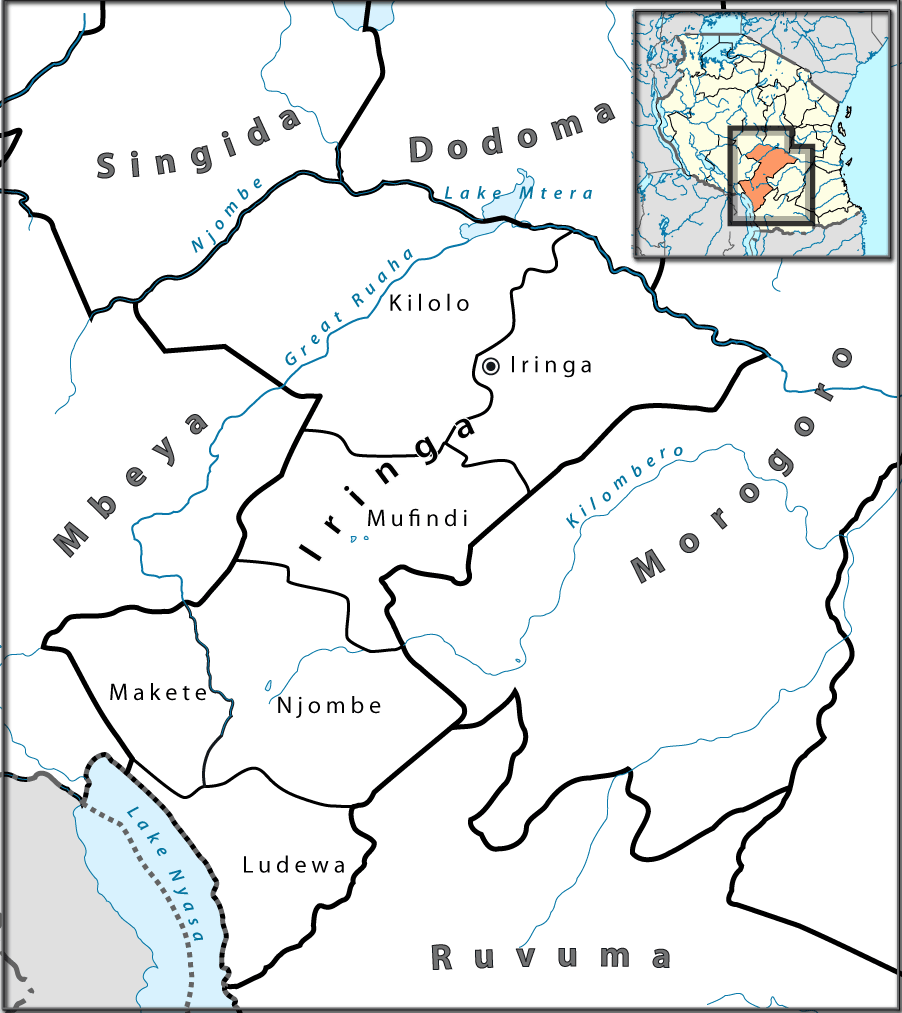
English: Location map of en:Tanzania. Français : Carte de géolocalisation de la fr:Tanzanie. Español: Mapa de georreferenciación de es:Tanzania. Equirectangular projection. 0.25° N, 28° W, 42° E, -13° S. Center : -6.375 35 |
| Rana | (UTC) |
| Masomi | |
| Marubucin |
|

|
This photo was taken by Lantus. If you use one of my photos, an email (account needed) or a message would be greatly appreciated. |
| This is a retouched picture, which means that it has been digitally altered from its original version. Modifications: Ausschnitt für Iringa-Region mit Distriktgrenzen. The original can be viewed here: Tanzania location map.svg:
|
I, the copyright holder of this work, hereby publish it under the following licenses:
This file is licensed under the Creative Commons Attribution-Share Alike 3.0 Unported, 2.5 Generic, 2.0 Generic and 1.0 Generic license.
- Za ka iya:
- a raba – dan kwafa, yadawa da aika aikin
- dan maimaita – dan daukar aikin
- A karkashin wannan sharuddan
- Jinginarwa – Dole ku bada jinjina da ta dace, samar da linki zuwa lasisin, da kuma bayyana ko kunyi sauyi. Zaku iya haka ta yadda ta dace, amma ba kowace hanya ba wanda zai nuna mai-lasisin yana goyon bayan ku ba ko goyon bayan amfanin da kuke yi ba.
- Yada ahaka – Idan kuka maimaita, sabuntawa, ko kari akan wannan, dole ku bayar da gudunmuwar ku karkashin iri daya ko lasisi data dace kamar na asali.

|
An bada damar a kofa, a yaɗa/ko sauya wannan kundi ƙarƙashin Lasisin GNU ta kyauta, Fitarwa na 1.2 ko duk wani fitarwa da zai biyo baya daga Gidauniyar Samar da Software ta Kyauta; ba tare da sauyin sashe ba, babu Rubutun Fuskar gaban shafi, kuma babu Rubutun bayan shafi. Kofi na lasisin na nan an sanya sa aciki ƙarƙashin sashen GNU Free Documentation License. |
Ku na iya zaɓan lasisin da kuke so.
Original upload log
This image is a derivative work of the following images:
- File:Tanzania_location_map.svg licensed with Cc-by-sa-3.0,2.5,2.0,1.0, GFDL
- 2009-07-25T00:30:42Z BetacommandBot 3096x2947 (848601 Bytes) move approved by: [[User:Sémhur]] This image was moved from [[:File:Tanzania location equirectangular map.svg]] =={{int:summary}}== {{Information |Description={{en|1=Location map of [[:en:Tanzania]].}} {{fr|1=Carte de gé
Uploaded with derivativeFX
Tarihin fayil
Ku latsa rana/lokaci ku ga fayil yadda yake a wannan lokaci
| Rana/Lokaci | Wadar sufa | Kusurwowi | Ma'aikaci | Bahasi | |
|---|---|---|---|---|---|
| na yanzu | 16:37, 23 ga Yuli, 2010 | | 902 × 1,013 (70 KB) | Lantus | zusätzlich Übersichtkarte eingebaut |
| 12:09, 23 ga Yuli, 2010 |  | 930 × 1,013 (55 KB) | Lantus | Schriftgrößen angepasst. | |
| 11:09, 23 ga Yuli, 2010 |  | 930 × 1,013 (58 KB) | Lantus | {{Information |Description={{en|1=Location map of en:Tanzania.}} {{fr|1=Carte de géolocalisation de la fr:Tanzanie.}} {{es|1=Mapa de georreferenciación de es:Tanzania.}} Equirectangular projection. 0.25° N, 28° W, 42° E, -13° S. Ce |
Amfani da fayil
Wadannan shafi na amfani wannan fayil:
Amfanin fayil a ko'ina
Wadannan sauran wikis suna amfani da fayil din anan
- Amfani a kan bg.wikipedia.org
- Amfani a kan ceb.wikipedia.org
- Amfani a kan el.wikipedia.org
- Amfani a kan en.wikipedia.org
- Amfani a kan es.wikipedia.org
- Amfani a kan ig.wikipedia.org
- Amfani a kan it.wikipedia.org
- Amfani a kan sw.wikipedia.org
- Amfani a kan ts.wikipedia.org
- Amfani a kan uk.wikipedia.org
- Amfani a kan vi.wikipedia.org
- Amfani a kan www.wikidata.org
- Amfani a kan yo.wikipedia.org
- Amfani a kan zu.wikipedia.org