File:Makambako.png

Page contents not supported in other languages.
Daga Wikipedia, Insakulofidiya ta kyauta.

Hoton asali(pikisal 538 × 610, girman fayil: 716 KB, irin MIME: image/png)

Wannan hoto yazo daga Wikimedia Commons kuma za'a iya amfani dashi a wasu projects. Anan kasa an nuna asalin bayanin shi

Taƙaici

This map image could be re-created using vector graphics as an SVG file. This has several advantages; see Commons:Media for cleanup for more information. If an SVG form of this image is available, please upload it and afterwards replace this template with {{vector version available|new image name}}.


It is recommended to name the SVG file “Makambako.svg”—then the template Vector version available (or Vva) does not need the new image name parameter.
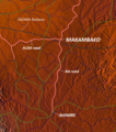
Bayani Map of Makambako, Njombe District, Tanzania
Rana
Masomi http://www.maps-for-free.com/
Marubucin Modified by Dr. Blofeld
Izini
(Sake amfani da wannan fayil)
http://www.maps-for-free.com/html/about.html

Lasisi

This screenshot either does not contain copyright-eligible parts or visuals of copyrighted software, or the author has released it under a free license (which should be indicated beneath this notice), and as such follows the licensing guidelines for screenshots of Wikimedia Commons. You may use it freely according to its particular license. Free software license:

GNU head

This work is free software; you can redistribute it and/or modify it under the terms of the GNU General Public License as published by the Free Software Foundation; either version 2 of the License, or any later version. This work is distributed in the hope that it will be useful, but without any warranty; without even the implied warranty of merchantability or fitness for a particular purpose. See version 2 and version 3 of the GNU General Public License for more details.

Note: if the screenshot shows any work that is not a direct result of the program code itself, such as a text or graphics that are not part of the program, the license for that work must be indicated separately.


Lasisi

w:en:Creative Commons
Jinginarwa
This file is licensed under the Creative Commons Attribution 3.0 Unported license.
Za ka iya:
  • a raba – dan kwafa, yadawa da aika aikin
  • dan maimaita – dan daukar aikin
A karkashin wannan sharuddan
  • Jinginarwa – Dole ku bada jinjina da ta dace, samar da linki zuwa lasisin, da kuma bayyana ko kunyi sauyi. Zaku iya haka ta yadda ta dace, amma ba kowace hanya ba wanda zai nuna mai-lasisin yana goyon bayan ku ba ko goyon bayan amfanin da kuke yi ba.

Take

Add a one-line explanation of what this file represents

Abubuwan da aka nuna a cikin wannan fayil

depicts Turanci

copyrighted Turanci

24 Oktoba 2010

media type Turanci

image/png

Tarihin fayil

Ku latsa rana/lokaci ku ga fayil yadda yake a wannan lokaci

Rana/LokaciWadar sufaKusurwowiMa'aikaciBahasi
na yanzu11:18, 24 Oktoba 2010Wadar sufa ta zubin 11:18, 24 Oktoba 2010538 × 610 (716 KB)Blofeld Dr.== Summary == {{convert to SVG|map}} {{Information |Description=Map of Makambako, Njombe District, Tanzania |Source=http://www.maps-for-free.com/ |Date=2010-10-24 |Author=Modified by Dr. Blofeld |Permission=http://www.maps-for-free.com/html/about.html |ot

Wadannan shafi na amfani wannan fayil:

Amfanin fayil a ko'ina

Wadannan sauran wikis suna amfani da fayil din anan