
File:VueAerienneCapFarinaTunisia.JPG
Yanayin wannan rigayi gani: 800 × 538 pixels. Wasu yarjejeniyoyi: 320 × 215 pixels | 640 × 430 pixels | 1,024 × 689 pixels | 1,280 × 861 pixels | 2,048 × 1,377 pixels.
Hoton asali (pikisal 2,048 × 1,377, girman fayil: 351 KB, irin MIME: image/jpeg)
Taƙaici
| Bayani |
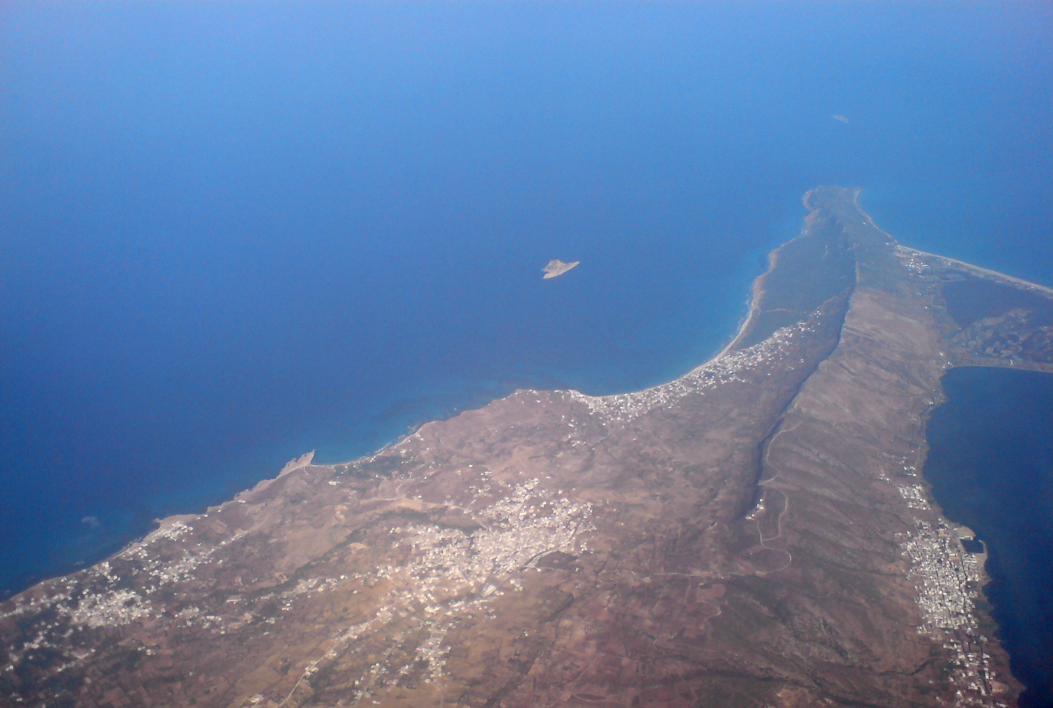
Français : Photo aérienne du Cap Farina en Tunisie, de gauche à droite: Sounine, RafRaf village, RafRaf plage, Ghar El Melh. On voit aussi l'île pilau à gauche et la petite île plane en haut.
English: Aerial photo of Cap Farina, Tunisia |
| Rana | |
| Masomi | Aikin na |
| Marubucin | Citizen59 / Retouche --Pinpin 06:25, 25 September 2007 (UTC) |
| Other versions |
 |
Lasisi
I, the copyright holder of this work, hereby publish it under the following licenses:

|
An bada damar a kofa, a yaɗa/ko sauya wannan kundi ƙarƙashin Lasisin GNU ta kyauta, Fitarwa na 1.2 ko duk wani fitarwa da zai biyo baya daga Gidauniyar Samar da Software ta Kyauta; ba tare da sauyin sashe ba, babu Rubutun Fuskar gaban shafi, kuma babu Rubutun bayan shafi. Kofi na lasisin na nan an sanya sa aciki ƙarƙashin sashen GNU Free Documentation License. |
| Wannan fayil ɗin an bada lasisin shi ƙarƙashin Creative Commons Attribution-Share Alike 3.0 Unported lasisi. | ||
| ||
| This licensing tag was added to this file as part of the GFDL licensing update. |
Ku na iya zaɓan lasisin da kuke so.
Tarihin fayil
Ku latsa rana/lokaci ku ga fayil yadda yake a wannan lokaci
| Rana/Lokaci | Wadar sufa | Kusurwowi | Ma'aikaci | Bahasi | |
|---|---|---|---|---|---|
| na yanzu | 21:01, 28 Satumba 2007 | | 2,048 × 1,377 (351 KB) | Pinpin | retouche |
| 13:03, 24 Satumba 2007 |  | 2,048 × 1,536 (797 KB) | Citizen59 | {{Information |Description=Aerial photo of Cap Farina, Tunisia |Source=travail personnel |Date=19 September, 2007 |Author= Citizen59 }} |
Amfani da fayil
Wadannan shafi na amfani wannan fayil:
Amfanin fayil a ko'ina
Wadannan sauran wikis suna amfani da fayil din anan
- Amfani a kan de.wikipedia.org
- Amfani a kan fr.wikipedia.org
- Amfani a kan ig.wikipedia.org
- Amfani a kan uk.wikipedia.org