Jump to content

Fayil:Ecozone-Biocountries-Afrotropic.svg

Page contents not supported in other languages.
Daga Wikipedia, Insakulofidiya ta kyauta.

Hoton asali(Fayil kin SVG, saƙar fikisal 2,487 x 2,770, girman fayil: 387 KB)

Wannan hoto yazo daga Wikimedia Commons kuma za'a iya amfani dashi a wasu projects. Anan kasa an nuna asalin bayanin shi

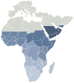
Bayani Map Afrotropic ecozone, one of six of the world's eight ecozones from Ecozones, subdivided further into Botanical countries as described by Plant Taxonomic Database Standards No. 2 [1]
Rana
Masomi Selected from Ecozones and Image:BlankMap-World6, compact.svg by User:Lokal_Profil
 
The SVG code is valid.
 
This vector image was created with Inkscape, and then manually edited
.
Marubucin carol
Izini
(Sake amfani da wannan fayil)
I, the copyright holder of this work, hereby publish it under the following license:
GNU head This work, previously under Public Domain, or a Free License has been digitally enhanced, I the creator of this work, hereby grant the permission to copy, distribute and/or modify this document under the terms of the GNU Free Documentation License, Version 1.2 or any later version published by the Free Software Foundation; with no Invariant Sections, no Front-Cover Texts, and no Back-Cover Texts.
w:en:Creative Commons
Jinginarwa Yada ahaka
Wannan fayil ɗin an bada lasisin shi ƙarƙashin Creative Commons Attribution-Share Alike 3.0 Unported lasisi.
Za ka iya:
  • a raba – dan kwafa, yadawa da aika aikin
  • dan maimaita – dan daukar aikin
A karkashin wannan sharuddan
  • Jinginarwa – Dole ku bada jinjina da ta dace, samar da linki zuwa lasisin, da kuma bayyana ko kunyi sauyi. Zaku iya haka ta yadda ta dace, amma ba kowace hanya ba wanda zai nuna mai-lasisin yana goyon bayan ku ba ko goyon bayan amfanin da kuke yi ba.
  • Yada ahaka – Idan kuka maimaita, sabuntawa, ko kari akan wannan, dole ku bayar da gudunmuwar ku karkashin iri daya ko lasisi data dace kamar na asali.
This licensing tag was added to this file as part of the GFDL licensing update.
Other versions

Take

Add a one-line explanation of what this file represents

Abubuwan da aka nuna a cikin wannan fayil

depicts Turanci

Wasu muhimman ba tare da Wikidata kayayyaki ba

copyrighted Turanci

18 Maris 2008

Tarihin fayil

Ku latsa rana/lokaci ku ga fayil yadda yake a wannan lokaci

Rana/LokaciWadar sufaKusurwowiMa'aikaciBahasi
na yanzu07:39, 4 ga Augusta, 2013Wadar sufa ta zubin 07:39, 4 ga Augusta, 20132,487 × 2,770 (387 KB)FlappiefhAdded South Sudan.
20:41, 20 Oktoba 2012Wadar sufa ta zubin 20:41, 20 Oktoba 20122,487 × 2,770 (387 KB)AnonMoosadjust margins
02:07, 8 Satumba 2012Wadar sufa ta zubin 02:07, 8 Satumba 2012744 × 1,052 (387 KB)JohnnyMrNinjabroke somehow Reverted to version as of 18:34, 20 March 2008
02:06, 8 Satumba 2012Wadar sufa ta zubin 02:06, 8 Satumba 2012752 × 762 (226 KB)JohnnyMrNinjareframe
18:34, 20 ga Maris, 2008Wadar sufa ta zubin 18:34, 20 ga Maris, 2008744 × 1,052 (387 KB)CarolSpears{{Information |Description=Map Afrotropic ecozone, one of six of the world's eight ecozones from Ecozones, subdivided further into ''Botanical countries'' as described by Plant Taxonomic Database Standards No. 2 [http://www.tdwg.org/TDWG_g

Babu shafuka da suke amfani da fayil din nan.

Amfanin fayil a ko'ina

bayannan meta