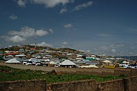
Fayil:Hill in the north-east part of Jos, Nigeria (15).jpg

Hoton asali (pikisal 3,008 × 2,000, girman fayil: 2.65 MB, irin MIME: image/jpeg)
Wannan hoto yazo daga Wikimedia Commons kuma za'a iya amfani dashi a wasu projects. Anan kasa an nuna asalin bayanin shi
Taƙaici
| BayaniHill in the north-east part of Jos, Nigeria (15).jpg | View near University Junction |
| Rana | |
| Masomi | Aikin na |
| Marubucin | Jiří Komárek |
| Camera location | 9° 57′ 30.78″ N, 8° 53′ 26.25″ E | View this and other nearby images on: OpenStreetMap |
|---|
Lasisi
- Za ka iya:
- a raba – dan kwafa, yadawa da aika aikin
- dan maimaita – dan daukar aikin
- A karkashin wannan sharuddan
- Jinginarwa – Dole ku bada jinjina da ta dace, samar da linki zuwa lasisin, da kuma bayyana ko kunyi sauyi. Zaku iya haka ta yadda ta dace, amma ba kowace hanya ba wanda zai nuna mai-lasisin yana goyon bayan ku ba ko goyon bayan amfanin da kuke yi ba.
- Yada ahaka – Idan kuka maimaita, sabuntawa, ko kari akan wannan, dole ku bayar da gudunmuwar ku karkashin iri daya ko lasisi data dace kamar na asali.


In printed material: Photo: © Jiří Komárek, JiriKomarek.net, Licence: Creative Commons BY-SA 4.0 (URL: https://creativecommons.org/licenses/by/4.0/legalcode), Source: Wikimedia Commons

| This work is free and may be used by anyone for any purpose. If you wish to use this content, you do not need to request permission as long as you follow any licensing requirements mentioned on this page.
The Wikimedia Foundation has received an e-mail confirming that the copyright holder has approved publication under the terms mentioned on this page. This correspondence has been reviewed by a Volunteer Response Team (VRT) member and stored in our permission archive. The correspondence is available to trusted volunteers as ticket #2014050710009283. If you have questions about the archived correspondence, please use the VRT noticeboard.
Ticket link: https://ticket.wikimedia.org/otrs/index.pl?Action=AgentTicketZoom&TicketNumber=2014050710009283
|
Take
Abubuwan da aka nuna a cikin wannan fayil
depicts Turanci
Wasu muhimman ba tare da Wikidata kayayyaki ba
copyright status Turanci
copyrighted Turanci
7 Yuli 2012
coordinates of the point of view Turanci
9°57'30.780"N, 8°53'26.254"E
source of file Turanci
original creation by uploader Turanci
captured with Turanci
Nikon D40 Turanci
exposure time Turanci
0.004 sakan
f-number Turanci
10
focal length Turanci
18 millimetre
ISO speed Turanci
200
media type Turanci
image/jpeg
Tarihin fayil
Ku latsa rana/lokaci ku ga fayil yadda yake a wannan lokaci
| Rana/Lokaci | Wadar sufa | Kusurwowi | Ma'aikaci | Bahasi | |
|---|---|---|---|---|---|
| na yanzu | 19:58, 9 ga Janairu, 2020 |  | 3,008 × 2,000 (2.65 MB) | Jiří Komárek | VicuñaUploader 1.23 |
Amfani da fayil
Wadannan shafi na amfani wannan fayil:
Amfanin fayil a ko'ina
Wadannan sauran wikis suna amfani da fayil din anan
bayannan meta
Wannan fayil ya ƙumshi ƙarin bayani daga kyamarar dijita ko sikanan da aka yi amfani da su.
Idan an sauya fayil kin, to wasu bayannan na ainahi ba za su fito ba sosai a cikin sabon fayil kin.
| Camera manufacturer | NIKON CORPORATION |
|---|---|
| Camera model | NIKON D40 |
| Exposure time | 1/250 sec (0.004) |
| F Number | f/10 |
| ISO speed rating | 200 |
| Date and time of data generation | 11:08, 7 ga Yuli, 2012 |
| Lens focal length | 18 mm |
| Latitude | 9° 57′ 30.78″ N |
| Longitude | 8° 53′ 26.25″ E |
| Orientation | Normal |
| Horizontal resolution | 300 dpi |
| Vertical resolution | 300 dpi |
| Software used | Ver.1.11 |
| File change date and time | 11:08, 7 ga Yuli, 2012 |
| Y and C positioning | Co-sited |
| Exposure Program | Manual |
| Exif version | 2.21 |
| Date and time of digitizing | 11:08, 7 ga Yuli, 2012 |
| Meaning of each component |
|
| Image compression mode | 4 |
| APEX exposure bias | −0.33333333333333 |
| Maximum land aperture | 3.6 APEX (f/3.48) |
| Metering mode | Pattern |
| Light source | Fine weather |
| Flash | Flash did not fire |
| DateTime subseconds | 40 |
| DateTimeOriginal subseconds | 40 |
| DateTimeDigitized subseconds | 40 |
| Supported Flashpix version | 1 |
| Color space | sRGB |
| Sensing method | One-chip color area sensor |
| File source | Digital still camera |
| Scene type | A directly photographed image |
| Custom image processing | Normal process |
| Exposure mode | Manual exposure |
| White balance | Manual white balance |
| Digital zoom ratio | 1 |
| Focal length in 35 mm film | 27 mm |
| Scene capture type | Standard |
| Scene control | None |
| Contrast | Normal |
| Saturation | Normal |
| Sharpness | Normal |
| Subject distance range | Unknown |
| Geodetic survey data used | WGS-84 |
| GPS tag version | 2.0.0.0 |
