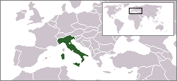
Fayil:LocationItaly.png
Appearance
LocationItaly.png (pikisal 250 × 115, girman fayil: 6 KB, irin MIME: image/png)
Tarihin fayil
Ku latsa rana/lokaci ku ga fayil yadda yake a wannan lokaci
| Rana/Lokaci | Wadar sufa | Kusurwowi | Ma'aikaci | Bahasi | |
|---|---|---|---|---|---|
| na yanzu | 11:56, 4 ga Yuni, 2006 |  | 250 × 115 (6 KB) | Rain74 | added Serbia-Montenegro border |
| 21:20, 5 Disamba 2004 |  | 250 × 115 (7 KB) | EugeneZelenko | Location map for the Italy.<br/>Originally created for English Wikipedia by Vardion.<br/>{{GFDL}} |
Amfani da fayil
Babu shafuka da suke amfani da fayil din nan.
Amfanin fayil a ko'ina
Wadannan sauran wikis suna amfani da fayil din anan
- Amfani a kan af.wiktionary.org
- Amfani a kan arc.wikipedia.org
- Amfani a kan ar.wikinews.org
- Amfani a kan av.wikipedia.org
- Amfani a kan az.wiktionary.org
- Amfani a kan bg.wikipedia.org
- Amfani a kan bi.wikipedia.org
- Amfani a kan bpy.wikipedia.org
- Amfani a kan br.wikipedia.org
- Amfani a kan br.wiktionary.org
- Amfani a kan bs.wikiquote.org
- Amfani a kan ca.wikinews.org
- Alonso guanya el Gran Premi d'Itàlia
- Itàlia: Silvio Berlusconi llança ultimàtum al govern Monti
- Plantilla:Infotaula Itàlia
- Secció:Itàlia
- Copa d'Europa de futbol 2012: Itàlia jugarà la final
- El sector públic italià fa vaga avui
- Itàlia: sorpresa a Venècia per l'èxit de la consulta independentista
- Itàlia rescata una embarcació a la deriva amb 450 immigrants
- Sergio Mattarella és el nou president d'Itàlia
- Itàlia: Amanda Knox finalment absolta de l'assassinat de Meredith Kercher
- Va morir William Salice, el creador de l'ou Kinder Sorpresa
- 30 desapareguts després allau que va sepultar un hotel a Itàlia
- El sud d'Itàlia pateix els impactes del cicló Apollo
- Amfani a kan ch.wikipedia.org
- Amfani a kan cr.wikipedia.org
- Amfani a kan cv.wikipedia.org
- Amfani a kan da.wikipedia.org
- Amfani a kan de.wikinews.org
- Amfani a kan de.wikivoyage.org
- Amfani a kan de.wiktionary.org
- Amfani a kan dsb.wikipedia.org
- Amfani a kan el.wikipedia.org
- Amfani a kan el.wiktionary.org
- Amfani a kan en.wikipedia.org
- User:DanielZM/test
- User:Marius~enwiki/sandbox
- Category:Catholic Church in Italy
- Category:Italian saints
- Category:Italian Roman Catholic priests
- Category:Roman Catholic dioceses in Italy
- List of non-marine molluscs of Italy
- List of moths of Italy
- User:Morriswa/My OCONUS travel
- List of moths of Italy (A-E)
Duba ƙarin amfanin wannan fayil.


