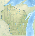
Fayil:USA Wisconsin relief location map.svg
Appearance

Size of this PNG preview of this SVG file: 585 × 599 pixels. Wasu yarjejeniyoyi: 234 × 240 pixels | 468 × 480 pixels | 749 × 768 pixels | 999 × 1,024 pixels | 1,998 × 2,048 pixels | 1,171 × 1,200 pixels.
Hoton asali (Fayil kin SVG, saƙar fikisal 1,171 x 1,200, girman fayil: 2.62 MB)
Tarihin fayil
Ku latsa rana/lokaci ku ga fayil yadda yake a wannan lokaci
| Rana/Lokaci | Wadar sufa | Kusurwowi | Ma'aikaci | Bahasi | |
|---|---|---|---|---|---|
| na yanzu | 21:20, 5 ga Faburairu, 2021 |  | 1,171 × 1,200 (2.62 MB) | SANtosito | Uploaded own work with UploadWizard |
Amfani da fayil
Wadannan shafi na amfani wannan fayil:
Amfanin fayil a ko'ina
Wadannan sauran wikis suna amfani da fayil din anan
- Amfani a kan bn.wikipedia.org
- Amfani a kan ca.wikipedia.org
- Amfani a kan de.wikipedia.org
- Sanguine
- WEAU-Sendemast
- Lake Mendota
- Lake Winnebago
- WITI-Sendeturm
- Geneva Lake
- Vorlage:Positionskarte USA Wisconsin
- Peshtigo Lake
- Kinnickinnic State Park
- Amnicon Falls State Park
- Big Foot Beach State Park
- Blue Mound State Park
- Brunet Island State Park
- Buckhorn State Park
- Castle Rock Lake
- Petenwell Lake
- Pilot Island (Wisconsin)
- Timms Hill
- Peterkin Pond
- Mill Pond Lake (Iron River)
- Barbo Lake (Wisconsin)
- Wyalusing State Park
- Copper Falls State Park
- Natural Bridge State Park (Wisconsin)
- WTPN
- WHRC
- WLCJ
- WHDG
- WAYY
- Washington Island (Michigansee)
- Door-Halbinsel
- Rock Island State Park (Wisconsin)
- Winslow Lake (Wisconsin)
- Glover-Bluff-Krater
- Alexander Lake (Lincoln County, Wisconsin)
- Pigeon Lake (Wisconsin)
- Alexander Lake (Douglas County, Wisconsin)
- Rock Lake (Crawfish River)
- Trout Bog Lake
- Trout Lake (See, Vilas County)
- Jones Island Sewage Plant
- Amfani a kan en.wikipedia.org
Duba ƙarin amfanin wannan fayil.

