
Fayil:Wassoulou map.png
Babu wata babbar saƙa.
Wassoulou_map.png (pikisal 282 × 267, girman fayil: 34 KB, irin MIME: image/png)
Taƙaici
| Bayani |
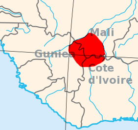
English: I created this, using the Gimp, and a blank area map from Wikpedia Commons, 2007-07-23.
Area map of the Wassoulou (Wassulu, Wassalou, Ouassalou) region of Mali, Guinea (Guinee), Cote d'Ivoire: West Africa. |
| Rana | 23 Yuli 2007 (original upload date) |
| Masomi | Transferred from en.wikipedia to Commons. |
| Marubucin | T L Miles at Turanci Wikipedia |
Lasisi
| This work has been released into the public domain by its author, T L Miles at Turanci Wikipedia. This applies worldwide. In some countries this may not be legally possible; if so: T L Miles grants anyone the right to use this work for any purpose, without any conditions, unless such conditions are required by law. |
Original upload log
The original description page was here. All following user names refer to en.wikipedia.
- 2007-07-23 16:56 T L Miles 282×267×8 (34707 bytes) I created this, using the Gimp, and a blank area map from Wikpedia Commons, 2007-07-23. Area map of the Wassoulou (Wassulu, Wassalou, Ouassalou) region of Mali, Guinea (Guinee), Cote d'Ivoire: West Africa.
Tarihin fayil
Ku latsa rana/lokaci ku ga fayil yadda yake a wannan lokaci
| Rana/Lokaci | Wadar sufa | Kusurwowi | Ma'aikaci | Bahasi | |
|---|---|---|---|---|---|
| na yanzu | 13:14, 12 ga Janairu, 2008 | | 282 × 267 (34 KB) | File Upload Bot (Magnus Manske) | {{BotMoveToCommons|en.wikipedia}} {{Information |Description={{en|I created this, using the Gimp, and a blank area map from Wikpedia Commons, 2007-07-23. Area map of the Wassoulou (Wassulu, Wassalou, Ouassalou) region of Mali, Guinea (Guinee), Cote d'Iv |
Amfani da fayil
Wadannan shafi na amfani wannan fayil:
Amfanin fayil a ko'ina
Wadannan sauran wikis suna amfani da fayil din anan
- Amfani a kan ca.wikipedia.org
- Amfani a kan cs.wikipedia.org
- Amfani a kan en.wikipedia.org
- Amfani a kan es.wikipedia.org
- Amfani a kan fi.wikipedia.org
- Amfani a kan fr.wikipedia.org
- Amfani a kan kcg.wikipedia.org
- Amfani a kan lt.wikipedia.org
- Amfani a kan nl.wikipedia.org
- Amfani a kan nqo.wikipedia.org
- Amfani a kan pt.wikipedia.org
- Amfani a kan sv.wikipedia.org
- Amfani a kan sw.wikipedia.org
- Amfani a kan uk.wikipedia.org
- Amfani a kan www.wikidata.org