
Fayil:Confluence Kadei and Mambere.jpg
Yanayin wannan rigayi gani: 787 × 600 pixels. Wasu yarjejeniyoyi: 315 × 240 pixels | 630 × 480 pixels | 888 × 677 pixels.
Hoton asali (pikisal 888 × 677, girman fayil: 405 KB, irin MIME: image/jpeg)
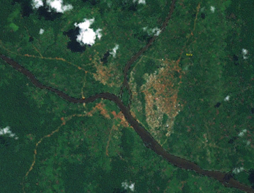
Taƙaici
| Bayani |
English: Confluence of Kadei and Mambere river at Nola, forming Sangha River |
| Rana | |
| Masomi | Worlwind |
| Marubucin | Nasa |
Lasisi
| This image is in the public domain because it is a screenshot from NASA’s globe software World Wind using a public domain layer, such as Blue Marble, MODIS, Landsat, SRTM, USGS or GLOBE.
|
 |
Tarihin fayil
Ku latsa rana/lokaci ku ga fayil yadda yake a wannan lokaci
| Rana/Lokaci | Wadar sufa | Kusurwowi | Ma'aikaci | Bahasi | |
|---|---|---|---|---|---|
| na yanzu | 14:04, 16 Satumba 2014 | | 888 × 677 (405 KB) | Peter in s | {{Information |Description ={{en|1=Confluence of Kadei and Mambere river at Nola}} |Source =Worlwind |Author =Nasa |Date =2014-09-13 |Permission = |other_versions = }} Category:Rivers of the Central African Republic |
Amfani da fayil
Wadannan shafi na amfani wannan fayil:
Amfanin fayil a ko'ina
Wadannan sauran wikis suna amfani da fayil din anan
- Amfani a kan arz.wikipedia.org
- Amfani a kan ceb.wikipedia.org
- Amfani a kan de.wikipedia.org
- Amfani a kan eo.wikipedia.org
- Amfani a kan fr.wikipedia.org
- Amfani a kan ko.wikipedia.org
- Amfani a kan pl.wikipedia.org
- Amfani a kan ro.wikipedia.org
- Amfani a kan ru.wikipedia.org
- Amfani a kan sv.wikipedia.org
- Amfani a kan tr.wikipedia.org
- Amfani a kan uk.wikipedia.org
- Amfani a kan www.wikidata.org
- Amfani a kan zh.wikipedia.org