
Fayil:East Above Corniglia Cinque Terre crop Sep23 A7C 06797.jpg

Yanayin wannan rigayi gani: 799 × 599 pixels. Wasu yarjejeniyoyi: 320 × 240 pixels | 640 × 480 pixels | 1,024 × 768 pixels | 1,280 × 960 pixels | 2,560 × 1,920 pixels | 4,626 × 3,470 pixels.
Hoton asali (pikisal 4,626 × 3,470, girman fayil: 19.17 MB, irin MIME: image/jpeg)
Taƙaici
| Bayani |
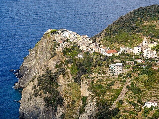
English: Corniglia perched on a 300 ft (91 m) cliff. View from the east, on Trail 587 Corniglia towards Volastra, about 260 m (850 ft) above the village. San Pietro Church middle right. Zigzag staircase down to the railway station lower right. Cinque Terre, Liguria, Italy |
|||
| Rana | ||||
| Masomi | Aikin na | |||
| Marubucin |
|
|||
| Other versions |
|


| Camera location | | View this and other nearby images on: OpenStreetMap |
|---|
|
The geographical information in this file was retrospectively estimated.
The location may therefore be somewhat imprecise. Verifying and refining these coordinates is strongly encouraged. |
|
This place is a UNESCO World Heritage Site, listed as
Portovenere, Cinque Terre, and the Islands (Italy).
|
Lasisi
I, the copyright holder of this work, hereby publish it under the following license:
This file is licensed under the Creative Commons Attribution-Share Alike 4.0 International license.
- Za ka iya:
- a raba – dan kwafa, yadawa da aika aikin
- dan maimaita – dan daukar aikin
- A karkashin wannan sharuddan
- Jinginarwa – Dole ku bada jinjina da ta dace, samar da linki zuwa lasisin, da kuma bayyana ko kunyi sauyi. Zaku iya haka ta yadda ta dace, amma ba kowace hanya ba wanda zai nuna mai-lasisin yana goyon bayan ku ba ko goyon bayan amfanin da kuke yi ba.
- Yada ahaka – Idan kuka maimaita, sabuntawa, ko kari akan wannan, dole ku bayar da gudunmuwar ku karkashin iri daya ko lasisi data dace kamar na asali.
Tarihin fayil
Ku latsa rana/lokaci ku ga fayil yadda yake a wannan lokaci
| Rana/Lokaci | Wadar sufa | Kusurwowi | Ma'aikaci | Bahasi | |
|---|---|---|---|---|---|
| na yanzu | 04:26, 22 ga Afirilu, 2024 | | 4,626 × 3,470 (19.17 MB) | Tagooty | Uploaded own work with UploadWizard |
Amfani da fayil
Babu shafuka da suke amfani da fayil din nan.
Amfanin fayil a ko'ina
Wadannan sauran wikis suna amfani da fayil din anan
- Amfani a kan en.wikipedia.org
- Amfani a kan frp.wikipedia.org
- Amfani a kan fr.wikipedia.org
- Utilisateur:Fagairolles 34
- Wikipédia:Wikimag
- Projet:Montréal/Infolettre
- Projet:Ville de Québec/Infolettre
- Modèle:Wiki magazine
- Projet:Acadie/Infolettre
- Utilisateur:Philippe rogez/Pages
- Projet:Louisiane/Infolettre
- Projet:Yukon/Infolettre
- Projet:Nunavut/Infolettre
- Projet:Territoires du Nord-Ouest/Infolettre
- Wikipédia:Réseaux sociaux/X/Publications
- Utilisateur:MG/Page3
- Utilisateur:MG/Drapeaux
- Wikipédia:Image du jour/19 mai 2024
- Wikipédia:Image du jour/mai 2024
- Wikipédia:Wikimag/2024/20