
File:Manicaland districts.png
Yanayin wannan rigayi gani: 776 × 600 pixels. Wasu yarjejeniyoyi: 311 × 240 pixels | 621 × 480 pixels | 994 × 768 pixels | 1,056 × 816 pixels.
Hoton asali (pikisal 1,056 × 816, girman fayil: 33 KB, irin MIME: image/png)
Taƙaici
| Bayani |
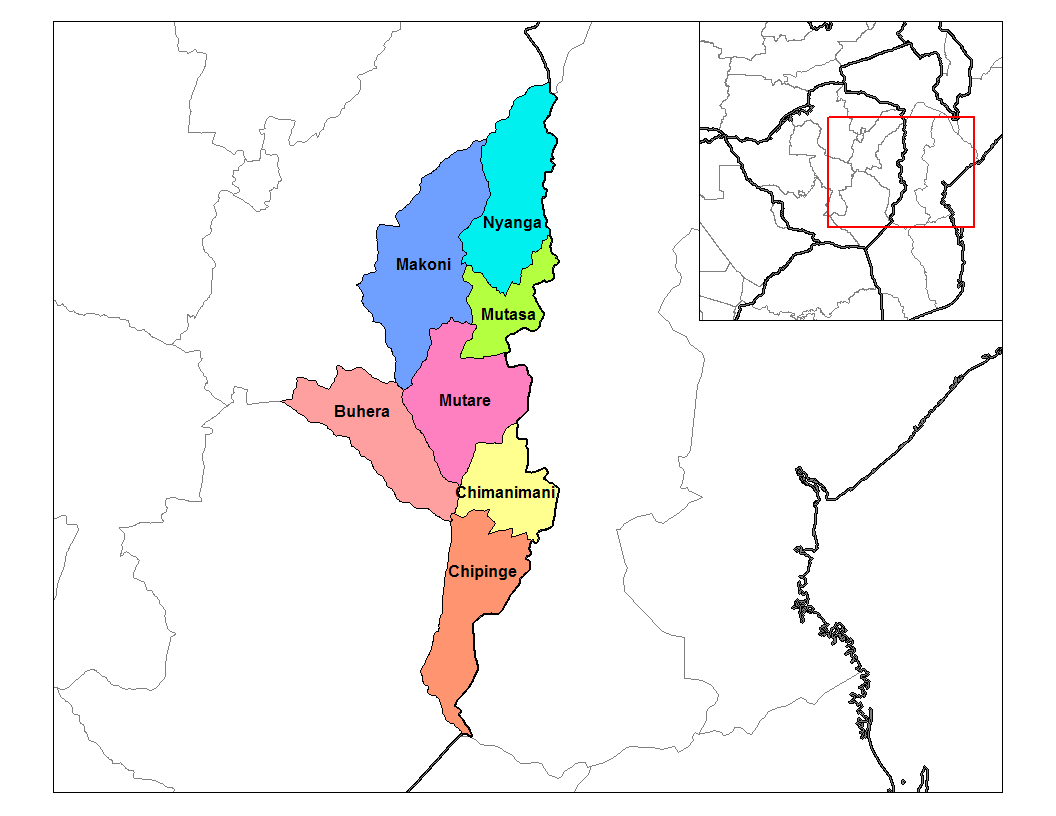
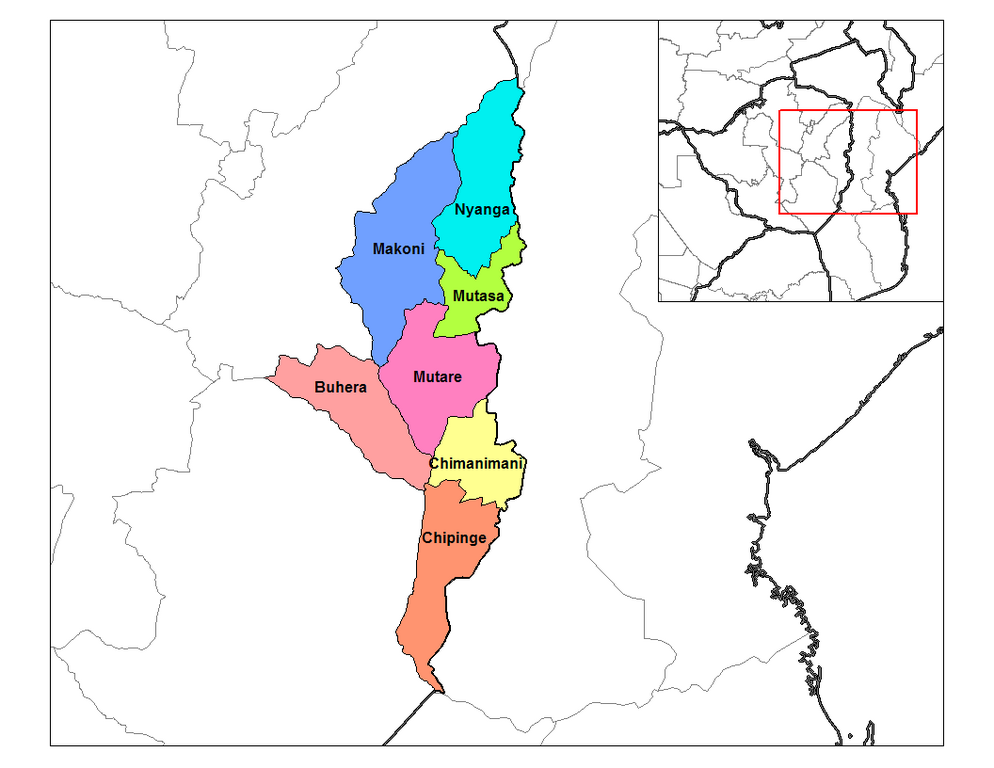
English: Map of the districts of Manicaland province of Zimbabwe. |
| Rana | 28 Satumba 2006 (original upload date) |
| Masomi |
Aikin na (Rarelibra) using MapInfo Professional v8.5 and various mapping resources. |
| Marubucin | Rarelibra at en.wikipedia |
Lasisi
| This work has been released into the public domain by its author, Rarelibra at Turanci Wikipedia. This applies worldwide. In some countries this may not be legally possible; if so: Rarelibra grants anyone the right to use this work for any purpose, without any conditions, unless such conditions are required by law. |
Original upload log
The original description page was here. All following user names refer to en.wikipedia.
- 2006-09-28 18:28 Rarelibra 1056×816× (33900 bytes) Map of the districts of Manicaland province of Angola. Created by ~~~~ for public domain use, using MapInfo Professional v8.5 and various mapping resources.
Tarihin fayil
Ku latsa rana/lokaci ku ga fayil yadda yake a wannan lokaci
| Rana/Lokaci | Wadar sufa | Kusurwowi | Ma'aikaci | Bahasi | |
|---|---|---|---|---|---|
| na yanzu | 15:28, 10 ga Janairu, 2011 | | 1,056 × 816 (33 KB) | Klik9 | {{Information |Description=Map of the districts of Manicaland province of Zimbabwe. |Source=Originally from [http://en.wikipedia.org en.wikipedia]; description page is (was) here |Date=2006 |Author=Rarelibra |Perm |
Amfani da fayil
Wadannan 2 shafuka suna amfani wannan fayil:
Amfanin fayil a ko'ina
Wadannan sauran wikis suna amfani da fayil din anan
- Amfani a kan ca.wikipedia.org
- Amfani a kan en.wikipedia.org
- Amfani a kan es.wikipedia.org
- Amfani a kan frr.wikipedia.org
- Amfani a kan ig.wikipedia.org
- Amfani a kan it.wikipedia.org
- Amfani a kan ja.wikipedia.org
- Amfani a kan ka.wikipedia.org
- Amfani a kan nl.wikipedia.org
- Amfani a kan no.wikipedia.org
- Amfani a kan pl.wikipedia.org
- Amfani a kan pt.wikipedia.org
- Amfani a kan ro.wikipedia.org
- Amfani a kan ru.wikipedia.org
- Amfani a kan sn.wikipedia.org
- Amfani a kan tr.wikipedia.org
- Amfani a kan ts.wikipedia.org
- Amfani a kan uk.wikipedia.org
- Amfani a kan ur.wikipedia.org
- Amfani a kan vi.wikipedia.org
- Amfani a kan www.wikidata.org
- Amfani a kan yo.wikipedia.org
- Amfani a kan zu.wikipedia.org