
File:Map Sudan Ohmdurman.png
Babu wata babbar saƙa.
Map_Sudan_Ohmdurman.png (pikisal 273 × 302, girman fayil: 16 KB, irin MIME: image/png)
- image is self-created
- created by de:Benutzer:Sven-steffen arndt
| I, the copyright holder of this work, release this work into the public domain. This applies worldwide. In some countries this may not be legally possible; if so: I grant anyone the right to use this work for any purpose, without any conditions, unless such conditions are required by law. |
Tarihin fayil
Ku latsa rana/lokaci ku ga fayil yadda yake a wannan lokaci
| Rana/Lokaci | Wadar sufa | Kusurwowi | Ma'aikaci | Bahasi | |
|---|---|---|---|---|---|
| na yanzu | 16:33, 17 ga Maris, 2017 | | 273 × 302 (16 KB) | Ras67 | frame and background removed |
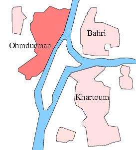
| 16:34, 23 ga Yuli, 2005 |  | 276 × 304 (20 KB) | Sven-steffen arndt | :'''Description''': city en:Ohmdurman near en:Khartoum in en:Sudan :'''Beschreibung''': Stadt de:Ohmdurman nahe de:Chartum in de:Sudan :image is self-created :'''created by''' de:Benutzer:Sven-steffen arndt {{PD-self}} |
Amfani da fayil
Wadannan shafi na amfani wannan fayil:
Amfanin fayil a ko'ina
Wadannan sauran wikis suna amfani da fayil din anan
- Amfani a kan af.wikipedia.org
- Amfani a kan ar.wikipedia.org
- Amfani a kan ceb.wikipedia.org
- Amfani a kan da.wikipedia.org
- Amfani a kan de.wikinews.org
- Amfani a kan el.wikipedia.org
- Amfani a kan en.wikipedia.org
- Amfani a kan es.wikipedia.org
- Amfani a kan et.wikipedia.org
- Amfani a kan fa.wikipedia.org
- Amfani a kan fi.wikipedia.org
- Amfani a kan fr.wikipedia.org
- Amfani a kan he.wikipedia.org
- Amfani a kan hr.wikipedia.org
- Amfani a kan hu.wikipedia.org
- Amfani a kan hy.wikipedia.org
- Amfani a kan it.wikipedia.org
- Amfani a kan ja.wikipedia.org
- Amfani a kan ko.wikipedia.org
- Amfani a kan nl.wikipedia.org
- Amfani a kan no.wikipedia.org
- Amfani a kan pt.wikipedia.org
- Amfani a kan ru.wikipedia.org
- Amfani a kan sco.wikipedia.org
- Amfani a kan sh.wikipedia.org
- Amfani a kan sk.wikipedia.org
- Amfani a kan sv.wikipedia.org
- Amfani a kan sw.wikipedia.org
- Amfani a kan uk.wikipedia.org
- Amfani a kan vi.wikipedia.org
- Amfani a kan www.wikidata.org
- Amfani a kan zh.wikipedia.org