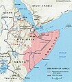
File:Somali map.jpg

Yanayin wannan rigayi gani: 524 × 600 pixels. Wasu yarjejeniyoyi: 210 × 240 pixels | 419 × 480 pixels | 671 × 768 pixels | 895 × 1,024 pixels | 1,280 × 1,465 pixels.
Hoton asali (pikisal 1,280 × 1,465, girman fayil: 1.92 MB, irin MIME: image/jpeg)
Tarihin fayil
Ku latsa rana/lokaci ku ga fayil yadda yake a wannan lokaci
| Rana/Lokaci | Wadar sufa | Kusurwowi | Ma'aikaci | Bahasi | |
|---|---|---|---|---|---|
| na yanzu | 11:01, 5 ga Faburairu, 2024 |  | 1,280 × 1,465 (1.92 MB) | Jacob300 | Reverted to version as of 18:33, 2 February 2024 (UTC) |
| 15:12, 3 ga Faburairu, 2024 |  | 1,055 × 1,209 (420 KB) | Janik98 | Reverted to version as of 13:23, 19 January 2024 (UTC) original CIA map, if you want to add Somaliland just upload a new version of this file | |
| 18:33, 2 ga Faburairu, 2024 |  | 1,280 × 1,465 (1.92 MB) | Jacob300 | Reverted to version as of 19:30, 12 January 2024 (UTC) | |
| 13:23, 19 ga Janairu, 2024 |  | 1,055 × 1,209 (420 KB) | Janik98 | Reverted to version as of 17:51, 10 January 2024 (UTC) original CIA map, if you want to add Somaliland just upload a new version of this file | |
| 19:30, 12 ga Janairu, 2024 |  | 1,280 × 1,465 (1.92 MB) | Jacob300 | Reverted to version as of 06:59, 10 January 2024 (UTC) | |
| 17:51, 10 ga Janairu, 2024 |  | 1,055 × 1,209 (420 KB) | Janik98 | Reverted to version as of 14:32, 6 January 2024 (UTC) original CIA map, if you want to add Somaliland just upload a new version of this file | |
| 06:59, 10 ga Janairu, 2024 |  | 1,280 × 1,465 (1.92 MB) | Subayerboombastic | Reverted to version as of 21:05, 31 December 2023 (UTC) | |
| 14:32, 6 ga Janairu, 2024 |  | 1,055 × 1,209 (420 KB) | Janik98 | Reverted to version as of 21:00, 29 December 2023 (UTC) original CIA map, if you want to add Somaliland just upload a new version of this file | |
| 21:05, 31 Disamba 2023 |  | 1,280 × 1,465 (1.92 MB) | Jacob300 | Reverted to version as of 04:55, 28 December 2023 (UTC) | |
| 21:00, 29 Disamba 2023 |  | 1,055 × 1,209 (420 KB) | Sharwa | Reverted to version as of 07:37, 5 November 2023 (UTC) |
Amfani da fayil
Wadannan shafi na amfani wannan fayil:
Amfanin fayil a ko'ina
Wadannan sauran wikis suna amfani da fayil din anan
- Amfani a kan af.wikipedia.org
- Amfani a kan af.wiktionary.org
- Amfani a kan am.wikipedia.org
- Amfani a kan ar.wikipedia.org
- Amfani a kan arz.wikipedia.org
- Amfani a kan ast.wikipedia.org
- Amfani a kan azb.wikipedia.org
- Amfani a kan be.wikipedia.org
- Amfani a kan bg.wikipedia.org
- Amfani a kan bn.wikipedia.org
- Amfani a kan ca.wikipedia.org
- Amfani a kan ce.wikipedia.org
- Amfani a kan cs.wikipedia.org
- Amfani a kan cy.wikipedia.org
- Amfani a kan da.wikipedia.org
- Amfani a kan de.wikipedia.org
- Amfani a kan en.wikipedia.org
- Amfani a kan en.wikibooks.org
- Amfani a kan eo.wikipedia.org
- Amfani a kan es.wikipedia.org
Duba ƙarin amfanin wannan fayil.
