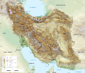
Fayil:Iran-geographic map.svg
Appearance

Size of this PNG preview of this SVG file: 695 × 600 pixels. Wasu yarjejeniyoyi: 278 × 240 pixels | 556 × 480 pixels | 890 × 768 pixels | 1,187 × 1,024 pixels | 2,373 × 2,048 pixels | 3,013 × 2,600 pixels.
Hoton asali (Fayil kin SVG, saƙar fikisal 3,013 x 2,600, girman fayil: 12.78 MB)
Tarihin fayil
Ku latsa rana/lokaci ku ga fayil yadda yake a wannan lokaci
| Rana/Lokaci | Wadar sufa | Kusurwowi | Ma'aikaci | Bahasi | |
|---|---|---|---|---|---|
| na yanzu | 22:14, 3 Oktoba 2024 |  | 3,013 × 2,600 (12.78 MB) | Zemen | File uploaded using svgtranslate tool (https://svgtranslate.toolforge.org/). Added translation for ckb. |
| 21:45, 20 Satumba 2023 |  | 3,013 × 2,600 (12.7 MB) | Socialdilema | File uploaded using svgtranslate tool (https://svgtranslate.toolforge.org/). Added translation for ca. | |
| 17:25, 20 Satumba 2023 |  | 3,013 × 2,600 (12.69 MB) | Socialdilema | File uploaded using svgtranslate tool (https://svgtranslate.toolforge.org/). Added translation for ca. | |
| 17:22, 20 Satumba 2023 |  | 3,013 × 2,600 (12.68 MB) | Socialdilema | File uploaded using svgtranslate tool (https://svgtranslate.toolforge.org/). Added translation for ca. | |
| 14:08, 8 Mayu 2020 |  | 3,013 × 2,600 (12.62 MB) | Yamaha5 | File uploaded using svgtranslate tool (https://tools.wmflabs.org/svgtranslate/). Added translation for fa. | |
| 20:44, 1 Mayu 2020 |  | 3,013 × 2,600 (12.62 MB) | Ikonact | + hidden Text: MW workaround for displaying translations | |
| 20:43, 1 Mayu 2020 |  | 3,013 × 2,600 (12.62 MB) | Ikonact | + hidden Text: MW workaround for displaying translations | |
| 20:39, 1 Mayu 2020 |  | 3,013 × 2,600 (12.62 MB) | Ikonact | File uploaded using svgtranslate tool (https://tools.wmflabs.org/svgtranslate/). Added translation for bg. | |
| 20:01, 1 Mayu 2020 |  | 3,013 × 2,600 (12.55 MB) | Ikonact | + hidden Text: MW workaround for displaying translations | |
| 21:49, 30 ga Afirilu, 2020 |  | 3,013 × 2,600 (12.55 MB) | Ahmad252 | File uploaded using svgtranslate tool (https://tools.wmflabs.org/svgtranslate/). Added translation for fa. |
Amfani da fayil
Wadannan shafi na amfani wannan fayil:
Amfanin fayil a ko'ina
Wadannan sauran wikis suna amfani da fayil din anan
- Amfani a kan ar.wikipedia.org
- Amfani a kan ast.wikipedia.org
- Amfani a kan avk.wikipedia.org
- Amfani a kan az.wikipedia.org
- Amfani a kan bg.wikipedia.org
- Amfani a kan bn.wikipedia.org
- Amfani a kan ca.wikipedia.org
- Amfani a kan ckb.wikipedia.org
- Amfani a kan cs.wikipedia.org
- Amfani a kan da.wikipedia.org
- Amfani a kan diq.wikipedia.org
- Amfani a kan el.wikipedia.org
- Amfani a kan en.wikipedia.org
- Amfani a kan eo.wikipedia.org
- Amfani a kan eu.wikipedia.org
- Amfani a kan fa.wikipedia.org
- جغرافیای ایران
- کاربر:Alieseraj
- توپوگرافی
- کاربر:مام وطن
- کاربر:Basp1
- کاربر:جعبه کاربر/مدافع خاک ایران
- کاربر:Gshahali
- بحث کاربر:Zzvf
- کاربر:Hamid Hassani
- کاربر:Derakhshan
- کاربر:Wiki center
- ویکیپدیا:گزیدن نگاره برگزیده/مه-۲۰۲۰
- کاربر:Arian.ramin
- ویکیپدیا:قهوهخانه/فنی/بایگانی ۶۵
- ویکیپدیا:گزیدن نگاره برگزیده/Iran-geographic map.svg
- کاربر:Adel2020
- ویکیپدیا:نگاره روز/اوت ۲۰۲۲
- کاربر:Amdanesh
- کاربر:Adolfzl64
Duba ƙarin amfanin wannan fayil.

