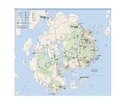
Fayil:NPS acadia-map.pdf
Appearance

Size of this JPG preview of this PDF file: 662 × 599 pixels. Wasu yarjejeniyoyi: 265 × 240 pixels | 530 × 480 pixels | 849 × 768 pixels | 1,131 × 1,024 pixels | 2,518 × 2,279 pixels.
Hoton asali (pikisal 2,518 × 2,279, girman fayil: 15.16 MB, irin MIME: application/pdf)
Tarihin fayil
Ku latsa rana/lokaci ku ga fayil yadda yake a wannan lokaci
| Rana/Lokaci | Wadar sufa | Kusurwowi | Ma'aikaci | Bahasi | |
|---|---|---|---|---|---|
| na yanzu | 00:39, 11 Mayu 2017 |  | 2,518 × 2,279 (15.16 MB) | RKBot | =={{int:filedesc}}== {{Information |description= {{en|1=Main Acadia National Park map, showing the majority of the park located on Mount Desert Island near Bar Harbor.}} |date= 2013-10-27 |source= U.S. National Park Service (http://npmaps.com/wp-conten... |
Amfani da fayil
Wadannan shafi na amfani wannan fayil:


