
Fayil:Admiralty Chart No 2759b Australia (Southern Portion) Compiled from the latest information in the Hydrographic Office, Published 1885, Corrections to 1896.jpg

Yanayin wannan rigayi gani: 800 × 530 pixels. Wasu yarjejeniyoyi: 320 × 212 pixels | 640 × 424 pixels | 1,024 × 679 pixels | 1,280 × 848 pixels | 2,560 × 1,697 pixels | 7,964 × 5,278 pixels.
Hoton asali (pikisal 7,964 × 5,278, girman fayil: 5.05 MB, irin MIME: image/jpeg)
_Compiled_from_the_latest_information_in_the_Hydrographic_Office,_Published_1885,_Corrections_to_1896.jpg)
Taƙaici
| Description |
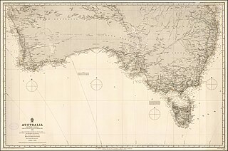
English: 1884 Admiralty Chart - Australia (Southern Portion) Compiled from the latest information in the Hydrographic Office |
||||||||||
| Rana | |||||||||||
| Masomi | https://www.raremaps.com/gallery/detail/40595/australia-southern-portion-compiled-from-the-latest-inform-british-admiralty | ||||||||||
| Maƙirƙiri |
|
||||||||||
| Georeferencing | |||||||||||
Lasisi
This work created by the United Kingdom Government is in the public domain.
This is because it is one of the following:
HMSO has declared that the expiry of Crown Copyrights applies worldwide (ref: HMSO Email Reply)
|
 |
Tarihin fayil
Ku latsa rana/lokaci ku ga fayil yadda yake a wannan lokaci
| Rana/Lokaci | Wadar sufa | Kusurwowi | Ma'aikaci | Bahasi | |
|---|---|---|---|---|---|
| na yanzu | 10:02, 28 ga Maris, 2020 | | 7,964 × 5,278 (5.05 MB) | Balkanique | Uploaded a work by British Admiralty from https://www.raremaps.com/gallery/detail/40595/australia-southern-portion-compiled-from-the-latest-inform-british-admiralty with UploadWizard |
Amfani da fayil
Wadannan shafi na amfani wannan fayil:
Amfanin fayil a ko'ina
Wadannan sauran wikis suna amfani da fayil din anan
- Amfani a kan en.wikipedia.org
- Amfani a kan www.wikidata.org
_Compiled_from_the_latest_information_in_the_Hydrographic_Office,_Published_1885,_Corrections_to_1896.jpg)